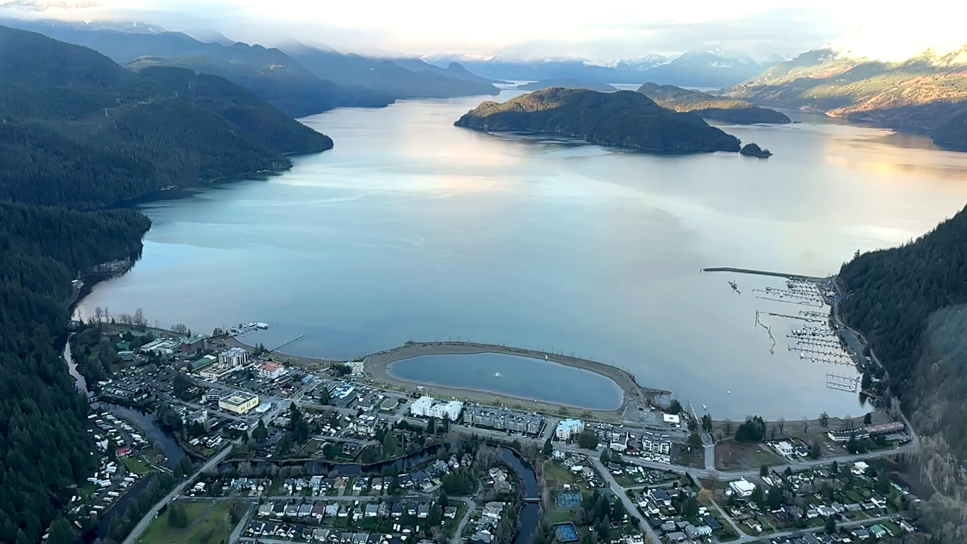
Aerial view across Harrison Hot Springs toward Harrison Lake and the mountains

An independent community initiative

Help build the public record of Harrison.

We collect photographs, video, documents, local knowledge and constructive ideas about five parts of Harrison Hot Springs and the surrounding region—then publish what we learn as the vision develops.

Aerial footage: Ralph van Woerden

The purpose

Evidence first. Ideas tested in public.

Harrison Rising is not presenting a finished development plan. It documents the place as it exists, identifies opportunities and problems, and tests possible directions against evidence, community experience and practical constraints.

The five concepts explain why material is being collected. They should change when better information or stronger ideas emerge.

Harrison Rising is not an official project of the Village of Harrison Hot Springs or Sts’ailes, and it does not claim to speak on their behalf.

The five study areas

Possible directions—not settled designs.

Every area record separates present conditions, the opportunity being explored, potential benefits, difficult questions and supporting evidence.

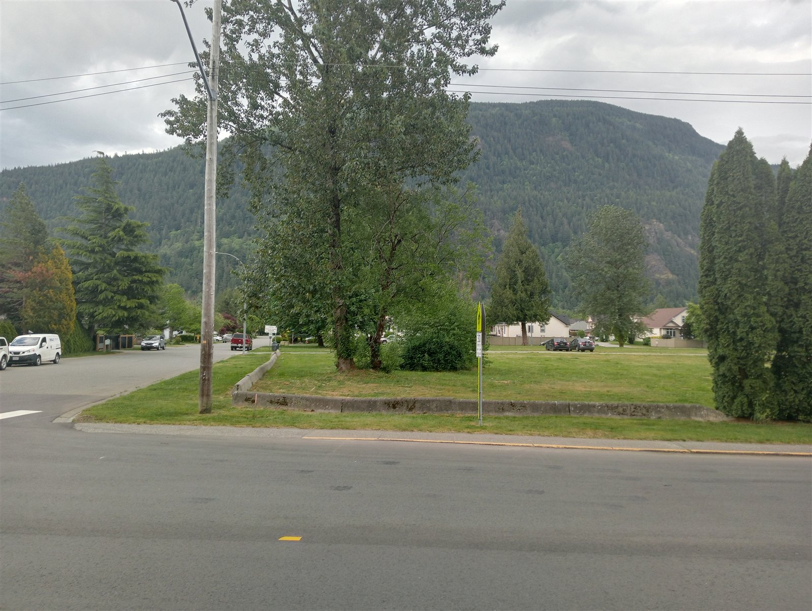
Current Area 1 overflow parking site with mature trees and mountains beyond
Existing condition
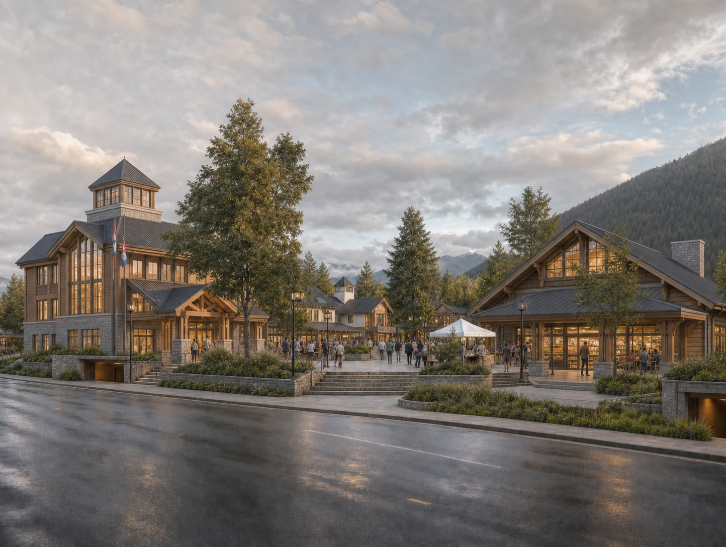
Concept illustration of the Area 1 civic plaza, municipal hall and grocery store above underground parking
Working vision
Existing and vision images published
Area 01

Village Heart

The place today

A surface overflow-parking block east of Hot Springs Road and south of Miami River Drive, beside the Visitor Information Centre and existing municipal uses.

Direction being explored

Study whether underground public parking could support a civic town square above, with a new municipal hall, grocery store, community services and small businesses.

Possible benefits

  • Free central surface land for people, landscaping and community activity
  • Keep parking within a comfortable walk of village services and the waterfront

Questions to resolve

  • Engineering, financing, access and construction phasing
  • Relocating Public Works while retaining and integrating the Visitor Information Centre
What would help now

Busy-day parking evidence, winter views, historical photographs and perspectives from every street edge.
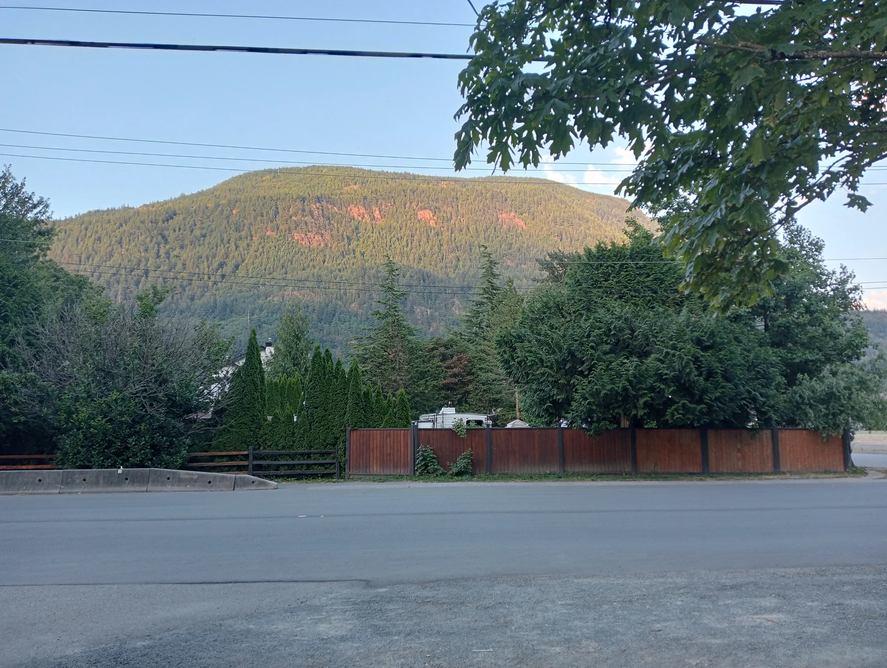
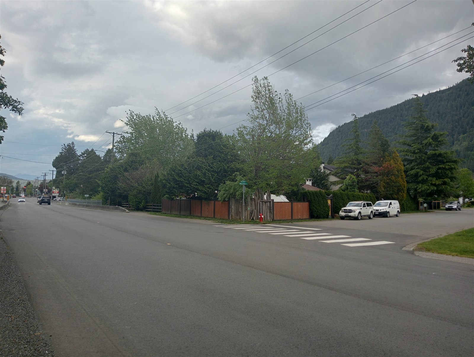
Existing Area 2 east frontage viewed directly from Hot Springs Road
Existing condition
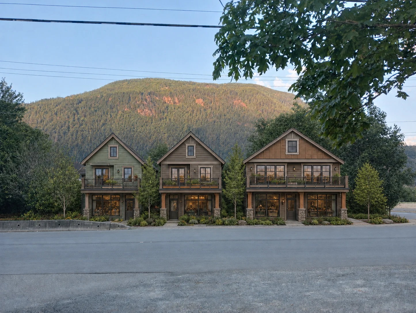
Concept illustration of a small-scale live/work frontage on Hot Springs Road
Working vision
Corner concept published; seasonal cabin market and Greenway pilot proposed
Area 02

Three-part Area 02

The place today

Area 02 brings together three distinct places: the private corner property at Hot Springs Road and Miami River Drive, the riverside log cabin beside the Miami River walkway, and the wider residential Greenway.

Direction being explored

Study three related but separate ideas: a modest corner live/work development; a seasonal local market in front of the home-occupation cabin; and a limited Greenway pilot with carefully regulated stalls integrated into selected residential properties.

Possible benefits

  • Give local residents practical ways to participate in the village economy
  • Preserve small-scale character and the natural riverside setting

Questions to resolve

  • Resident privacy, security, ecological protection and the narrow walkway
  • Clear limits on permitted goods, deliveries, hours, stall design and signs
What would help now

Privacy-safe property-edge photographs from interested pilot residents, ideas for the separate log-cabin market concept, seasonal river conditions and resident feedback on the proposed safeguards.

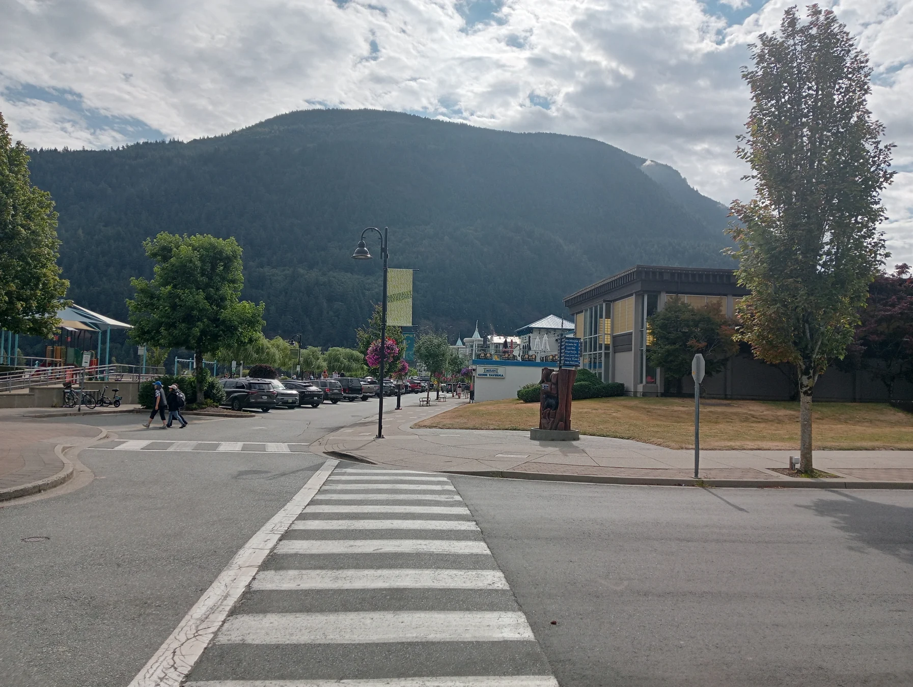
Existing pool property and Esplanade intersection from the exact glass-bridge concept viewpoint
Existing pool
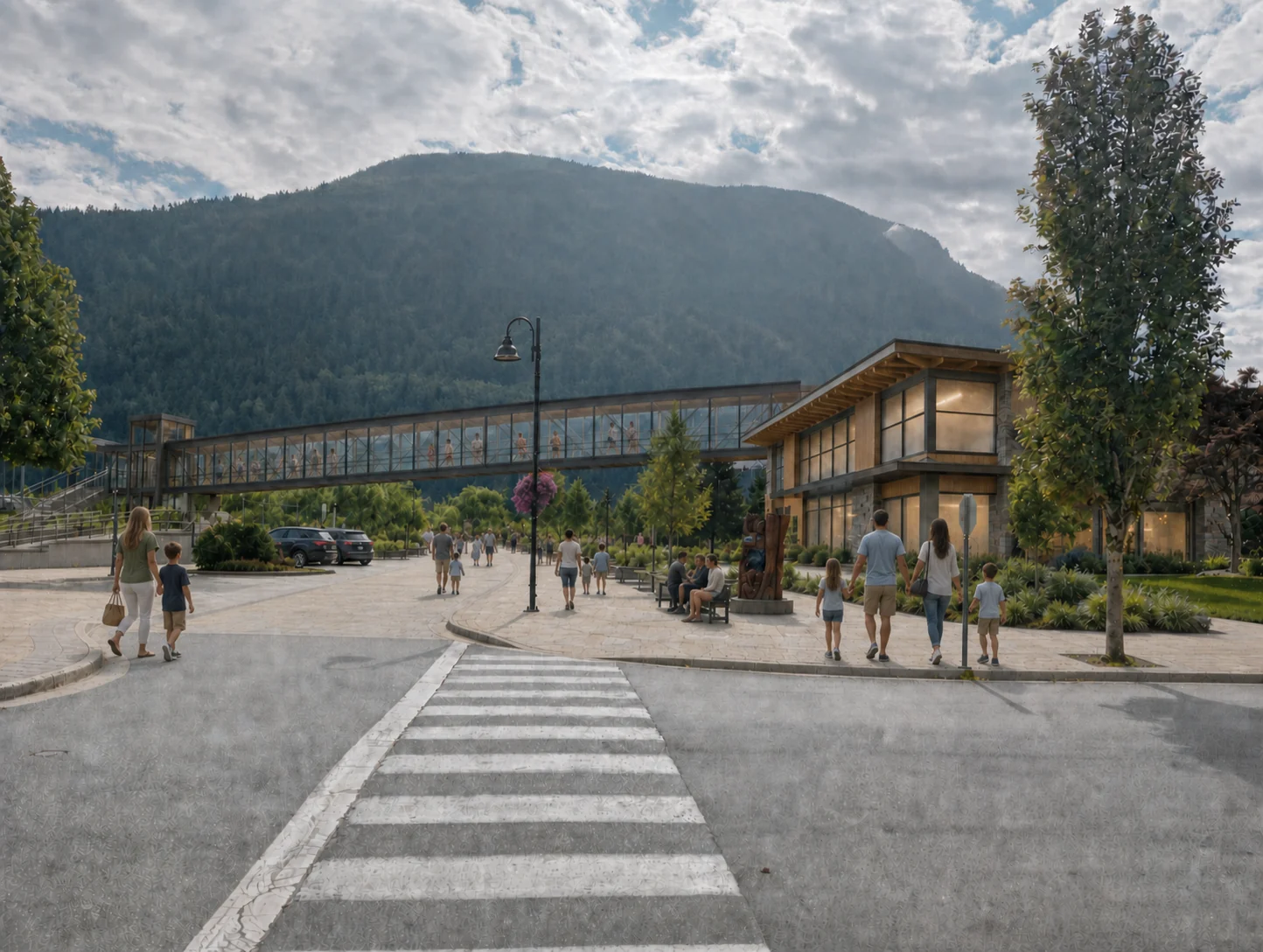
Concept illustration of the modernized pool, glazed bridge, stone promenade and limited parking
Pool vision
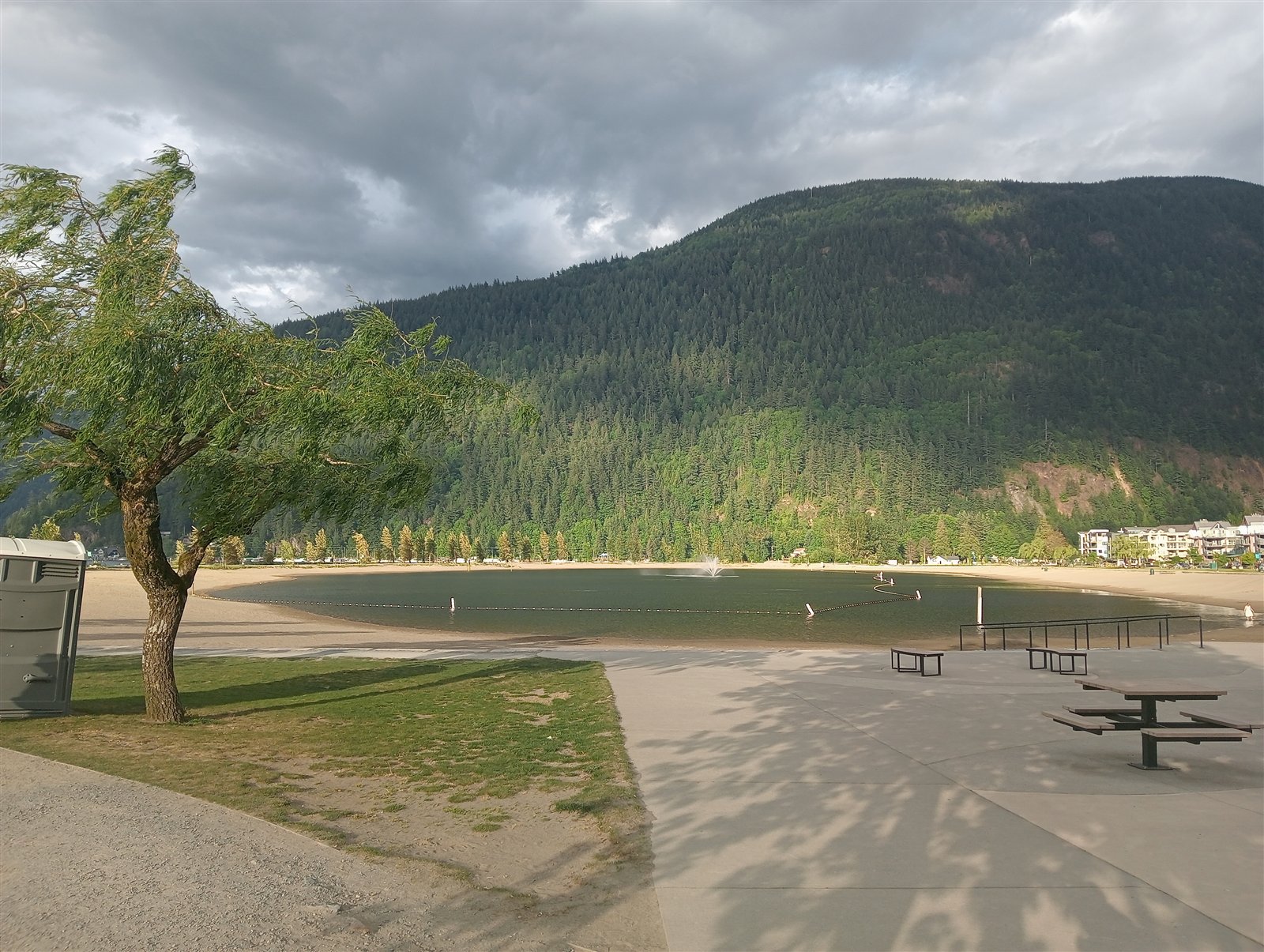
Lagoon beach and mountains from the recreation plaza
Existing lagoon
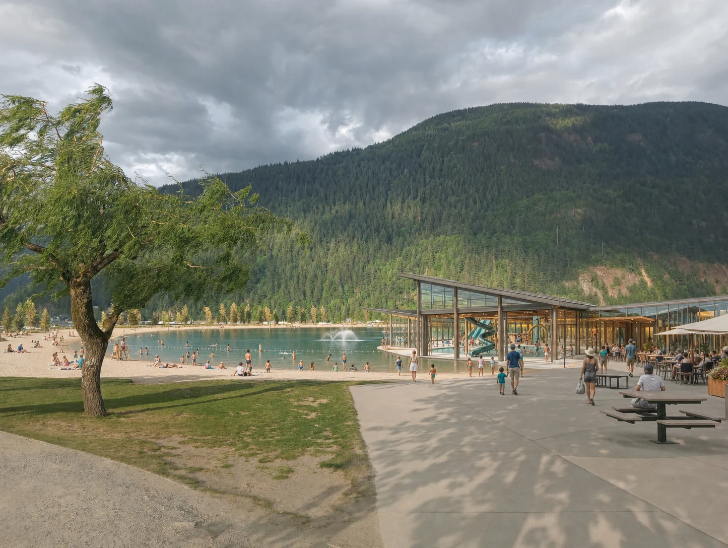
Approved concept illustration of the seasonally adaptable lagoon waterpark
Lagoon vision
Two existing and vision pairs published
Area 03

Recreation Zone

The place today

The current public-pool property, Esplanade Avenue and the lagoon beach operate as separate spaces with strong year-round potential.

Direction being explored

Explore a family aquatic destination connected by a glazed bridge to a seasonally adaptable lagoon-beach waterpark, with Esplanade serving primarily as a pedestrian promenade.

Possible benefits

  • Create more year-round family recreation
  • Support restaurants, small shops and public activity along Esplanade

Questions to resolve

  • Property ownership, feasibility, operating costs and accessibility
  • Lagoon water quality, environmental protection and seasonal design
What would help now

Historical pool records, summer and winter views, accessibility observations and ideas for family aquatic activities.

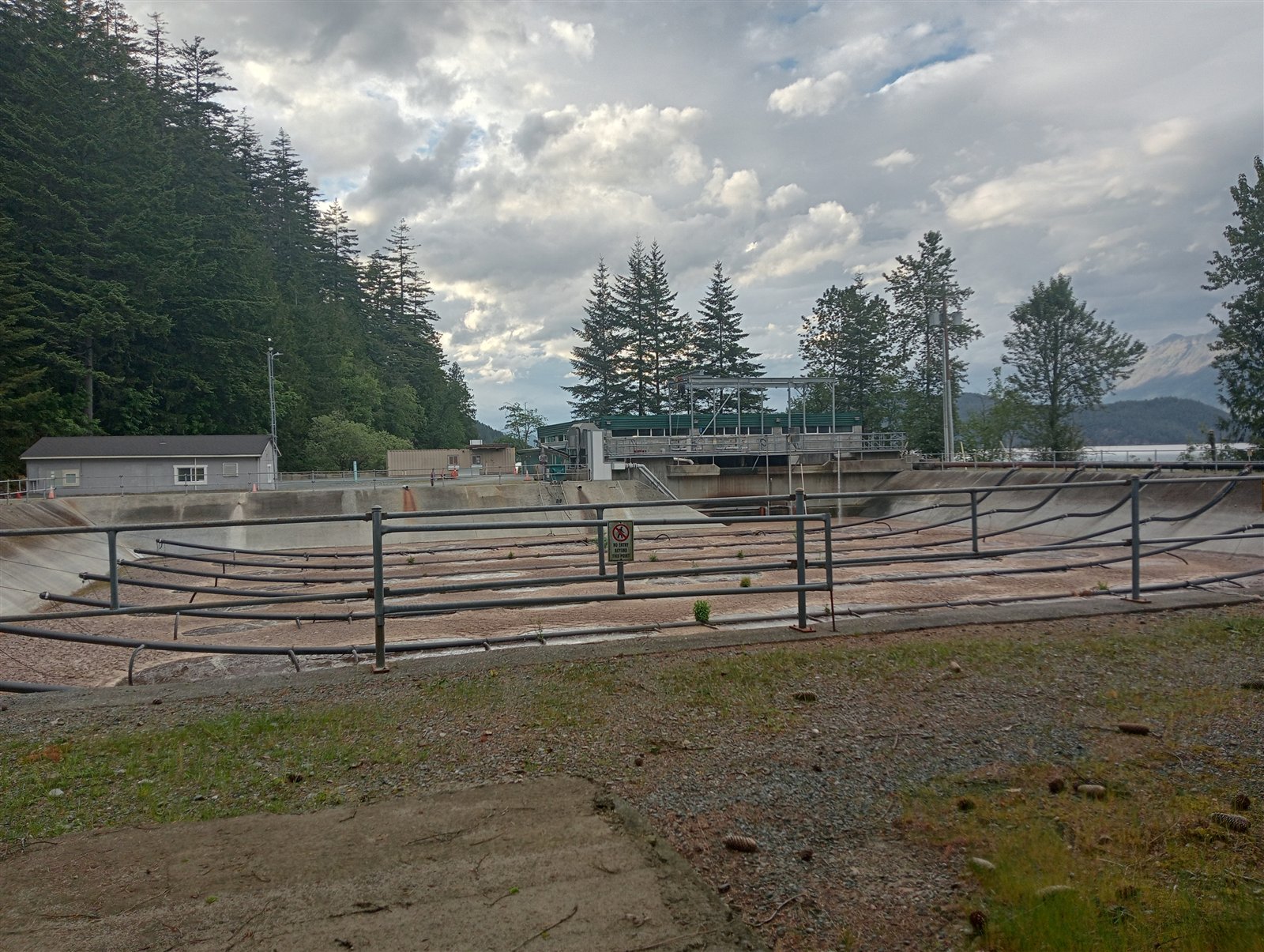
Current wastewater treatment plant and treatment basin near Harrison Lake
Existing condition
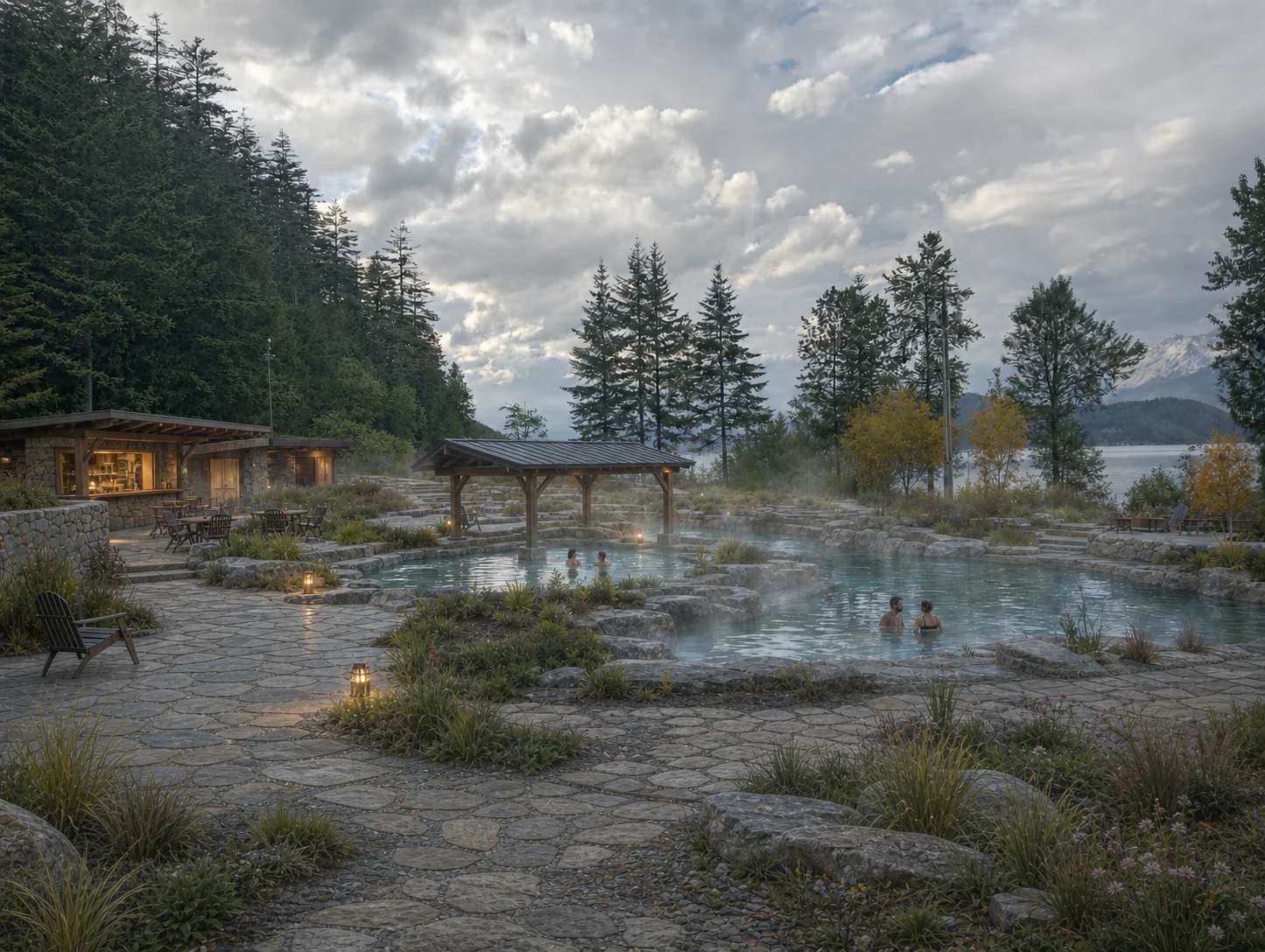
Concept illustration of a low-profile outdoor thermal wellness park on the remediated Area 4 site
Working vision
Existing and vision images published
Area 04

Wellness Opportunity

The place today

The wastewater-treatment plant occupies valuable lakeside land and has experienced pressure during periods of high stormwater inflow.

Direction being explored

Reassess whether a technically, environmentally and financially feasible regional connection to Kent could provide a stronger long-term solution and allow the remediated site to support a public thermal-wellness use.

Possible benefits

  • Compare long-term regional infrastructure with repeated site upgrades
  • Potentially recover lakeside land for public wellness and economic activity

Questions to resolve

  • Engineering, cost, governance, remediation and intergovernmental agreement
  • Thermal-water access, environmental approvals and a viable public model
What would help now

Engineering and environmental studies, missing 2008-2010 records, historical photographs, sightlines and first-hand knowledge.

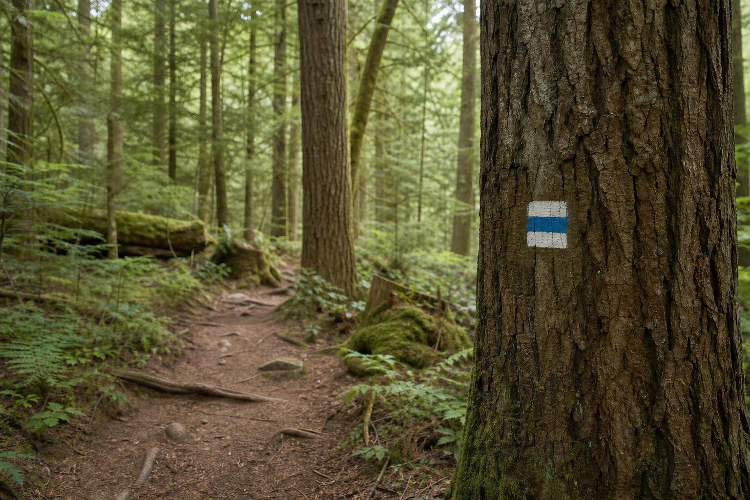
Concept illustration of one discreet blue and white route marker beside a forest trailConcept illustration - proposed marking systemWorking method published
Area 05

Trail Network

The place today

Existing trails, informal routes and cycling connections vary in condition, authorization, signage and ease of navigation.

Direction being explored

Improve existing routes first, adapt a proven colour-stripe wayfinding system and gradually develop authorized connections supported by a trained volunteer club.

Possible benefits

  • Make outdoor routes easier to understand and maintain
  • Support recreation, local businesses and practical cycling connections

Questions to resolve

  • Land access, authorization, ecology, liability and insurance
  • Coordination with First Nations, landowners and government agencies
What would help now

Trail maps, confusing junctions, damaged signs, unsafe cycling gaps, drainage problems and regional aerial footage.

How Harrison Rising works

A public record that improves over time.

Every contribution should have a clear path from the inbox to useful public knowledge.

01

Collect

Photos, video, documents, memories, technical knowledge, concerns and ideas.

02

Review

Check relevance, source, permissions, privacy and what remains uncertain.

03

Share

Publish approved evidence with credit, context and honest status labels.

04

Refine

Show what was heard, what changed and which questions remain unresolved.

The record so far

Real material, visible sources and honest labels.

The public catalogue now combines current site photography, contributed aerial material, linked official records, working methods and clearly identified concept illustrations.

5complete area records
43public catalogue entries
21photographs and visual records
22public and method sources
Aerial view across Harrison Hot Springs toward Harrison Lake and the mountains
Regional · Aerial

Five-area aerial overview

Aerial survey view used to understand the village, lake, mountains and relationships between the study areas.

HRP001 · Credit: Ralph van Woerden
Current Area 1 overflow parking area
Area 1 · Photograph

Overflow parking - present condition

Street-level record of the proposed Village Heart site and its mountain backdrop.

HRP101 · Credit: Harrison Rising archive
Visitor Information Centre beside Area 1
Area 1 · Photograph

Visitor Information Centre context

The retained Visitor Information Centre beside the present overflow-parking block.

HRP102 · Credit: Harrison Rising archive
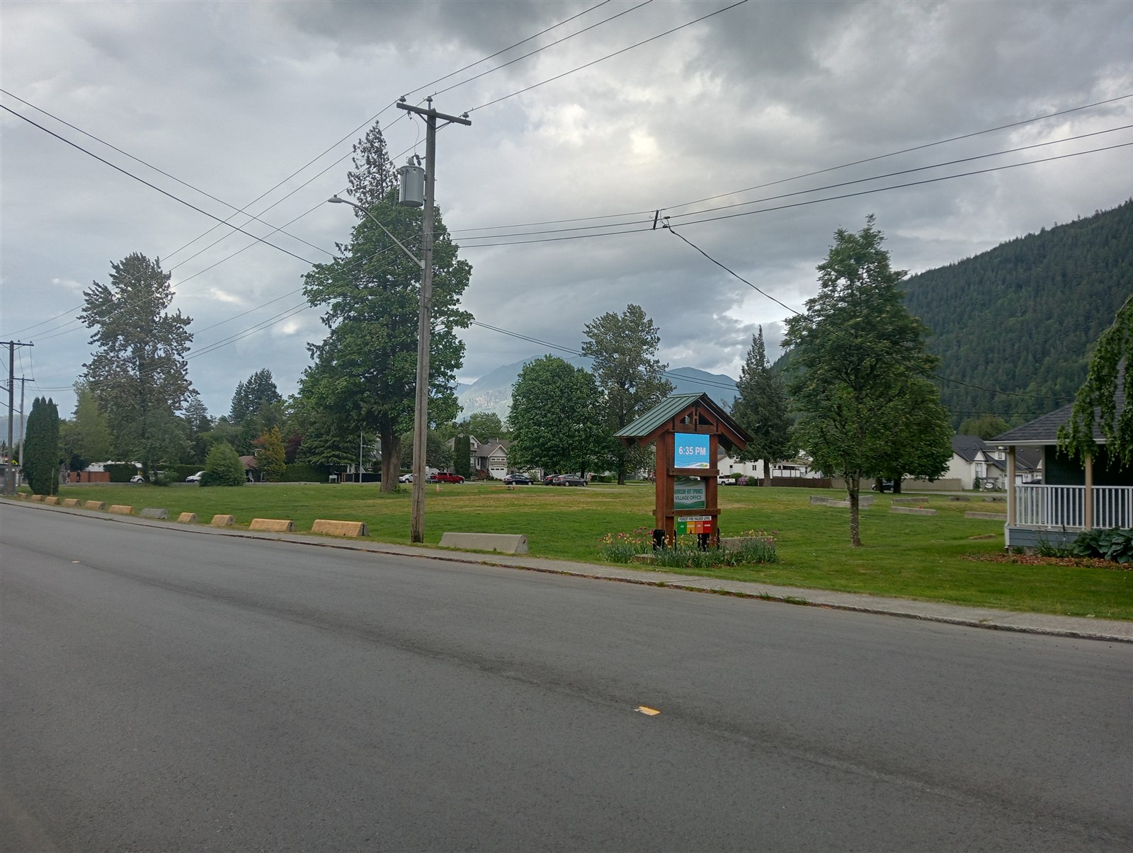
Area 1 edge at Miami River Drive
Area 1 · Photograph

Miami River Drive site edge

Present northern edge of the Area 1 block at Miami River Drive.

HRP103 · Credit: Harrison Rising archive
Concept illustration of the Area 1 Village Heart above underground parking
Area 1 · Concept

Village Heart working vision

Approved website concept showing a civic plaza, municipal hall, grocery store and visible underground-parking access. It is an illustration, not a settled site plan.

HRC101 · Credit: Harrison Rising concept illustration
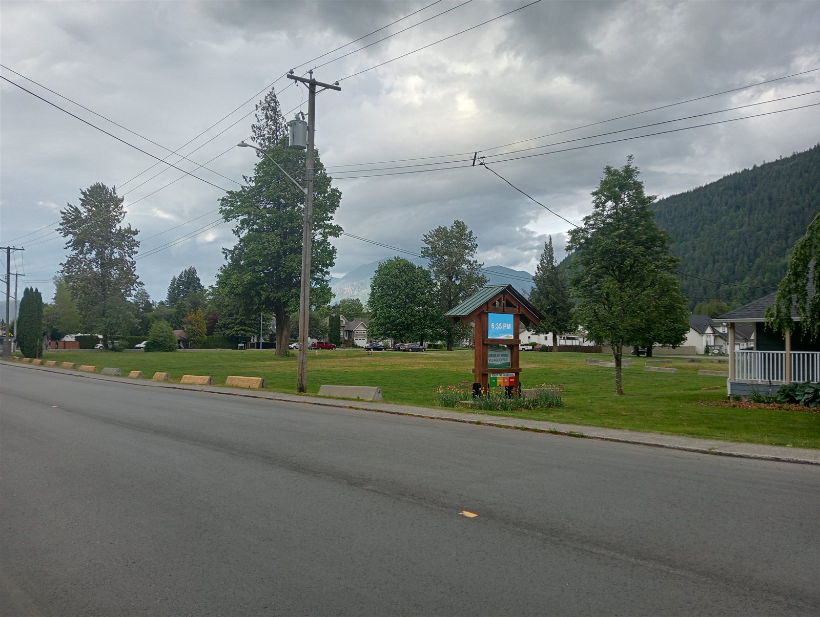
Area 2 at Hot Springs Road and Miami River Drive
Area 2 · Photograph

Hot Springs Road and Miami River Drive

Street context for the proposed live/work frontage.

HRP201 · Credit: Harrison Rising archive
Public now

Searchable evidence library

Filter by area and material type, open official sources, and see whether each item is a verified record, contributed material, working method or concept.

Open the library

What would help most

Specific gaps are more useful than a general call for files.

Ordinary, truthful views are often more useful than promotional images. These priorities will change as gaps are filled.

Area 1

Busy summer-day parking views and historical images of the gateway block

Area 2

Ideas for the separate cabin-market concept, Miami River conditions and resident privacy concerns

Area 3

Pool history, ownership records and winter views of the pool-lagoon relationship

Area 4

Documents that complete the public record of the 2008-2010 wastewater decision

Area 5

Local trail junctions, damaged signs, cycling gaps and route maps

Closing the loop

See what the project is learning and changing.

Participation is credible only when people can see the record, unresolved disagreements and changes made in response to better information.

What we received

Evidence library

Approved images and public sources with IDs, credits, context and review labels.

Browse the record →
What is unresolved

Open questions

Engineering, ownership, environmental, financial and community questions remain visible.

Review the five areas →
How input mattered

What changed

Areas 1, 2 and 4 now show one existing-condition image beside the current working concept. Area 3 shows separate existing-and-vision pairs for the public pool and lagoon waterpark. The Area 2 log-cabin market remains a separate concept still to be developed.

Read the change record →
Structured participation

Community Pulse

See how preferences will be verified, counted and reported—and why the result will not be presented as an official vote.

Read the method →

Contribute to the record

Share evidence, an idea, a concern—or a correction.

Choose a contribution type, follow the short checklist and tell us whether the material may be shown publicly. Large videos can be shared by cloud-storage link.

See how to contribute

Your contact information and raw correspondence remain private.