The five study areas

Full working records—not finished plans.

Each record shows the current place, the direction being explored, possible benefits, difficult questions, approved photographs and the sources collected so far.

Area 01

Village Heart and Underground Parking

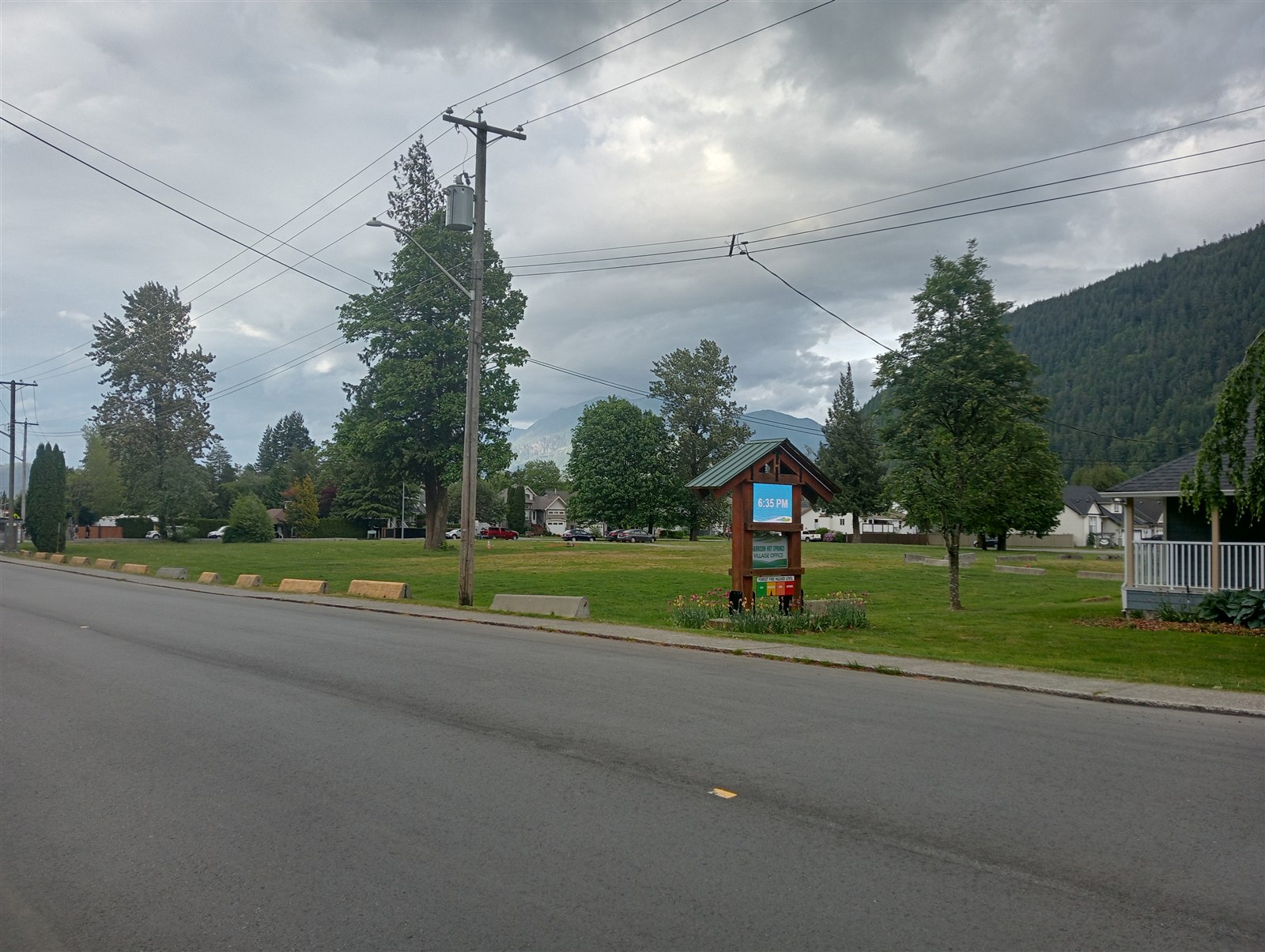
Existing and vision images published

Working overview

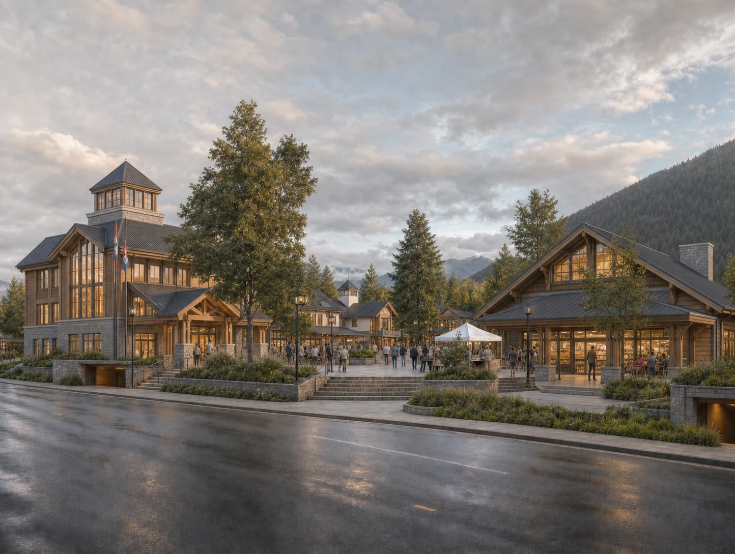
Area 1 is the current overflow-parking block at the village entrance. The working concept places a large public parking facility below grade and uses the surface for a compact civic town square.

The square could include a new municipal hall, grocery store, community services, cafes and small businesses. Its character would be shaped primarily by Harrison's natural setting, with references to local settler-era architectural history and cultural features developed respectfully with Sts'ailes participation.

Harrison's compact centre is an important advantage. A unified parking location here could keep the waterfront, shops and public services within a comfortable walk while reducing pressure to use valuable central land for scattered surface parking.

Possible benefits

  • Free central surface land for people, landscaping and community activity
  • Keep parking within a comfortable walk of village services and the waterfront

Immediate constraints

  • Engineering, financing, access and construction phasing
  • Relocating Public Works while retaining and integrating the Visitor Information Centre
Design and decision principles

What should guide the work

  1. Keep the existing Visitor Information Centre and give it a clear role in the new civic district.
  2. Relocate Public Works functions that are incompatible with a pedestrian civic centre.
  3. Protect important mountain views and mature landscape features where practical.
  4. Design parking access, deliveries and emergency access before fixing the plaza layout.
  5. Use a scale and architectural language that remain recognizably Harrison.

Still unresolved

Questions that must remain visible

  • What is the verified parking demand on ordinary days, summer weekends and during major events?
  • Can below-grade parking be delivered safely given groundwater, drainage and flood conditions?
  • Which public and commercial uses can support year-round village life without overwhelming the site?
  • Where can Public Works be relocated, at what cost and with what operational effect?

Evidence currently connected to this area

8 public catalogue entries

What would help now
Busy-day parking evidence, winter views, historical photographs and perspectives from every street edge.

Email an Area 01 contribution
Area 02

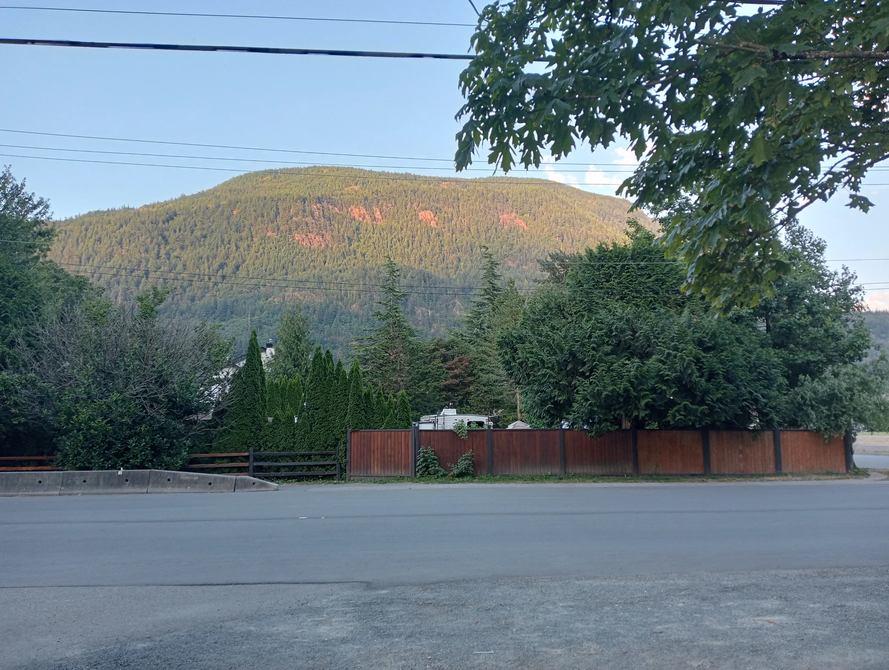
Hot Springs Road: Three Related Area 02 Proposals

Corner concept published; seasonal cabin market and Greenway pilot proposed

Working overview

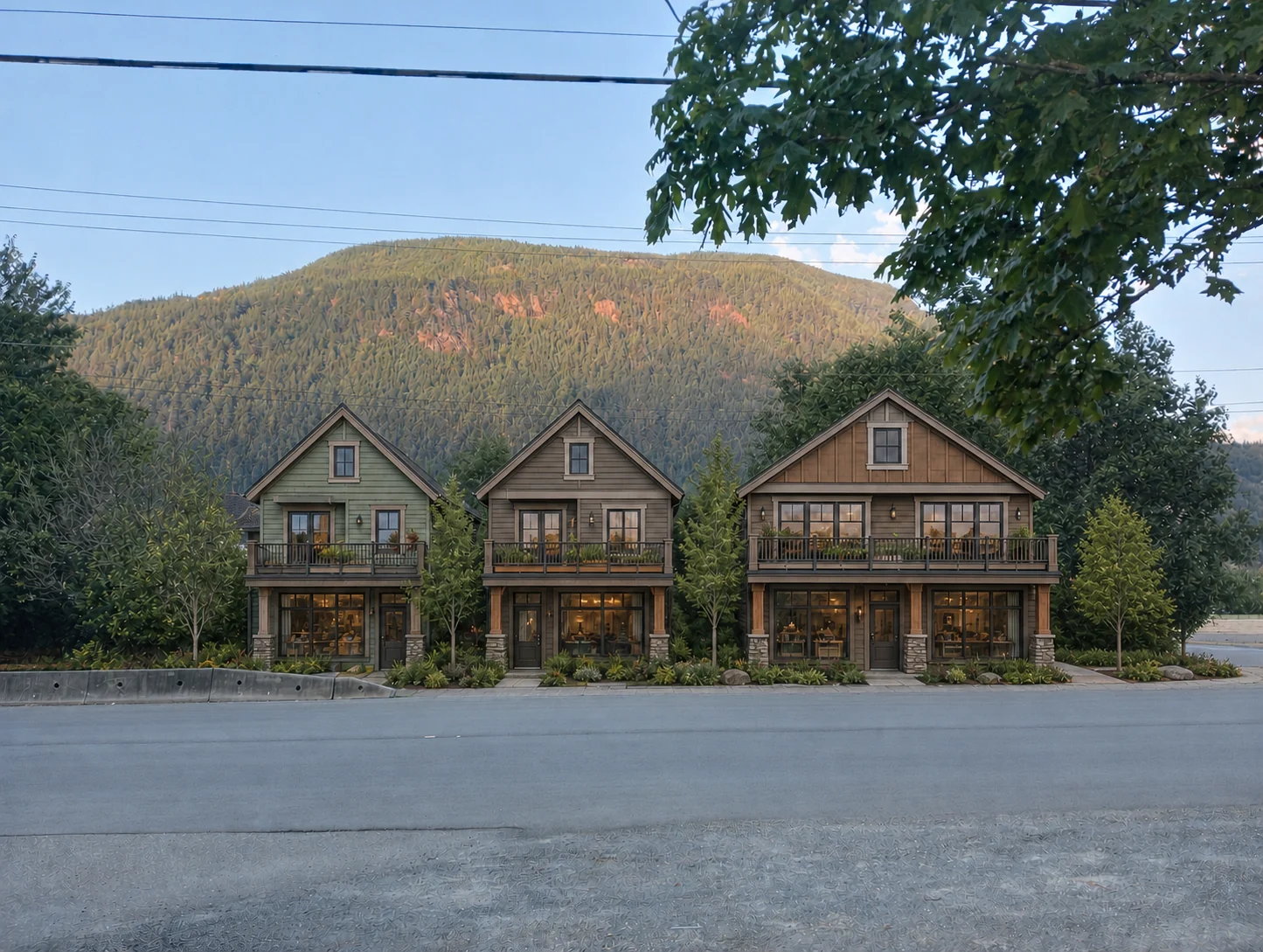
Corner live/work development

At the corner of Hot Springs Road and Miami River Drive, the idea is to create a small-scale live/work transition between the Village Heart and the recreation area. The architecture would use natural materials, a human scale and a character suited to Harrison's mountain setting, supporting homes, local enterprise and an active street edge while remaining flexible as the concept develops.

Riverside home-occupation cabin

The log cabin sits beside Hot Springs Road at the entrance to the Miami River walkway and serves a home-occupation use. A small seasonal market in front could offer local produce, crafts and mobile carts.

Miami River Greenway pilot

A one-season pilot would allow no more than three carefully selected participating properties along the wider residential Greenway, with small stalls integrated into private property and strict safeguards for neighbours, privacy, ecology, servicing and walkway safety.

Possible benefits

  • Give local residents practical ways to participate in the village economy
  • Preserve small-scale character and the natural riverside setting

Immediate constraints

  • Resident privacy, security, ecological protection and the narrow walkway
  • Clear limits on permitted goods, deliveries, hours, stall design and signs

Design and decision principles

What should guide the work

  1. Keep the cabin's home-occupation role and the human-scale character of its riverside setting.
  2. Place parking and servicing on Miami River Drive so storefronts can address Hot Springs Road.
  3. Test the idea through a monitored one-season pilot capped at three non-transferable authorizations across the entire Greenway.
  4. Select participating properties through transparent published criteria rather than first-come, first-served approval, with spacing and a balanced product mix considered to prevent a continuous shopping strip.
  5. Allow Greenway-facing sales only for goods substantially grown, made, created, prepared or transformed by registered Harrison Hot Springs residents; prohibit wholesale inventory and general resale.
  6. Require each stall operator to maintain a contributor register and consolidate community-producer supplies through the property's normal street frontage.
  7. Keep repair intake, parcel pickup, general resale, appointments and other destination-service activity at the normal street frontage rather than the Greenway.
  8. Keep all deliveries, storage, waste collection, utilities and servicing at the established residential street frontage and within normal residential-scale activity.
  9. Operate Greenway-facing stalls during daylight hours only and close and secure every display at dusk.
  10. Use one small informative sign per property, no larger than 0.10 square metres, in rustic wood or natural stone with no plastic, lighting, reflective material or animated display.
  11. Use a small, restrained entrance sign rather than actively promoting the greenway as a tourism attraction.

Still unresolved

Questions that must remain visible

  • Which interested residences have a suitable, privacy-sensitive property edge for the pilot?
  • Can three coordinated Temporary Use Permits provide an appropriate one-season test of Greenway-facing outdoor stalls before any permanent zoning amendment specifically allowing such stalls is considered?
  • What river setbacks, flood conditions and environmental approvals apply?

Evidence currently connected to this area

9 public catalogue entries

What would help now
Privacy-safe property-edge photographs from interested pilot residents, ideas for the separate log-cabin market concept, seasonal river conditions and resident feedback on the proposed safeguards.

Email an Area 02 contribution
Area 03

Pool, Esplanade and Lagoon Waterpark

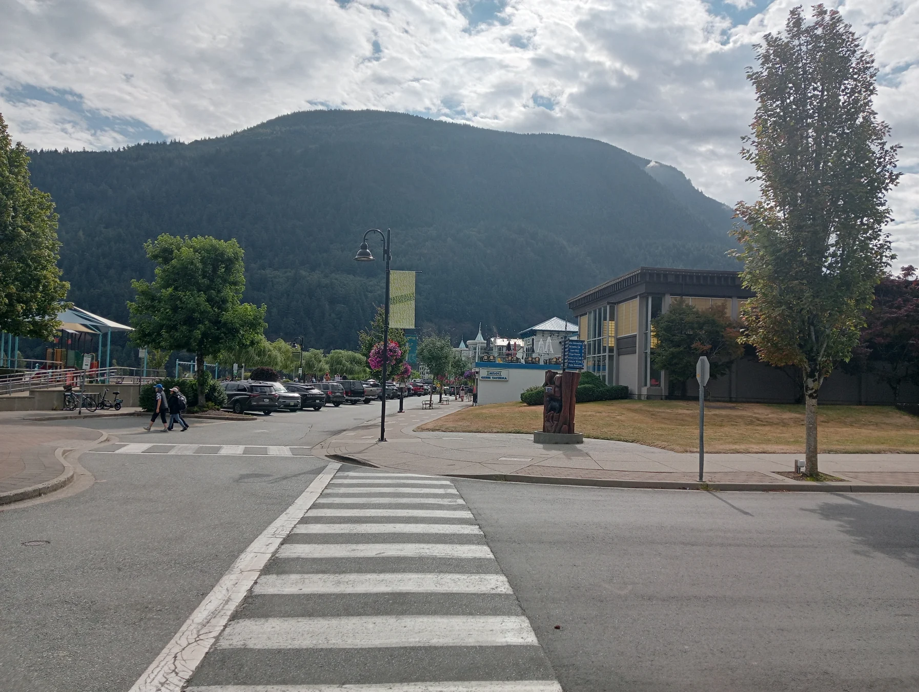
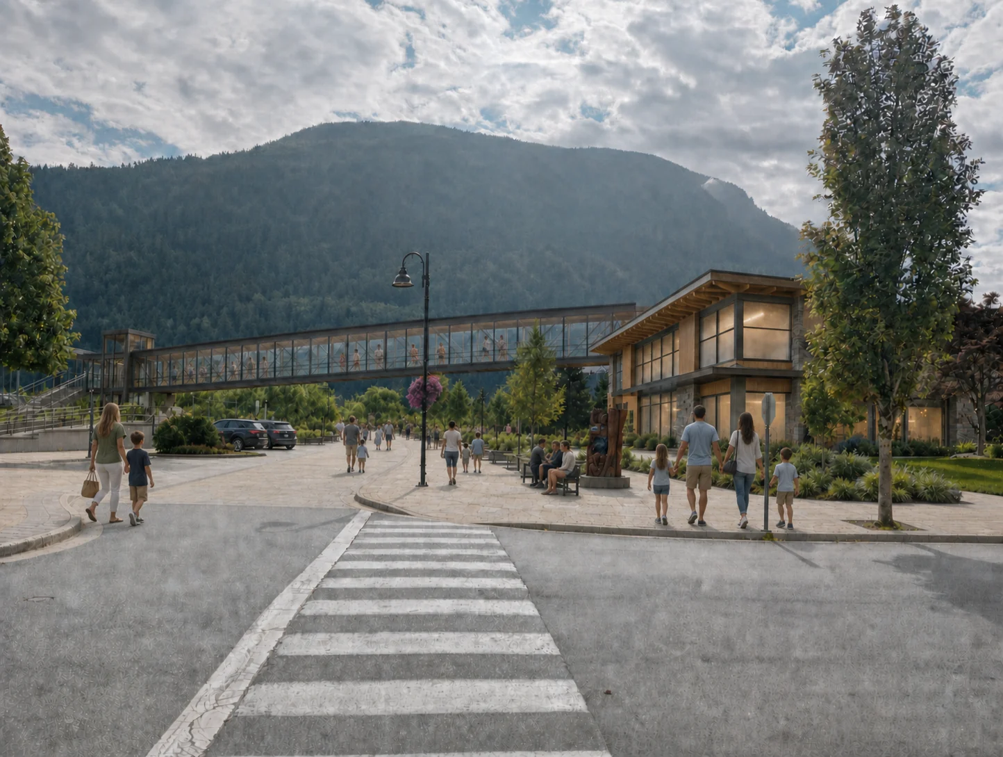
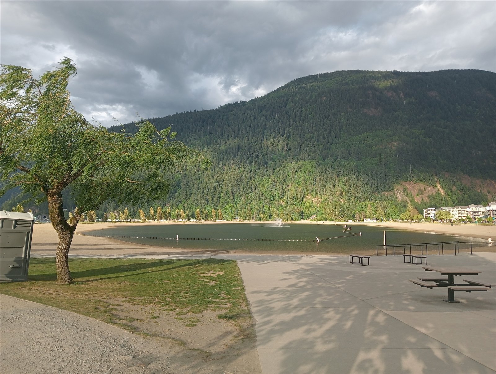
Two existing and vision pairs published

Working overview

Area 3 explores transforming the current public-pool property into a year-round family aquatic destination. If the Area 4 wellness park proceeds, thermal bathing would be concentrated there rather than duplicated in Area 3.

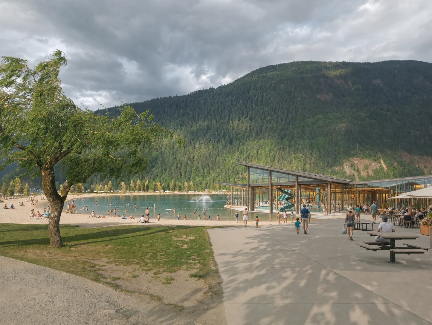
A glazed pedestrian bridge over Esplanade could connect the pool property directly to the lagoon beach. A seasonally adaptable glass pavilion could shelter part of the natural sandy beach during colder months, providing warm-water play areas, shallow pools, slides and splash features.

During summer, large sections of the enclosure could open to the beach. A separate outdoor section could incorporate lagoon water only when ongoing monitoring confirms that water quality, environmental protection and public-health requirements are satisfied.

Esplanade would function primarily as a pedestrian promenade with restaurants, cafes, small shops, outdoor seating and public activity. Limited accessible parking would remain nearby; regular visitor parking would be within a short walk in Area 1.

Possible benefits

  • Create more year-round family recreation
  • Support restaurants, small shops and public activity along Esplanade

Immediate constraints

  • Property ownership, feasibility, operating costs and accessibility
  • Lagoon water quality, environmental protection and seasonal design

Design and decision principles

What should guide the work

  1. Make family recreation and year-round use the primary purpose.
  2. Keep the glass bridge and pavilion visually light and subordinate to lake and mountain views.
  3. Maintain universal access between the pool property, bridge, beach and promenade.
  4. Treat lagoon-water use as conditional on monitoring and public-health approval.
  5. Develop an ownership and operating model that benefits residents, the village, the region and the current property owner.

Still unresolved

Questions that must remain visible

  • What ownership, access and thermal-water obligations affect the current public-pool property?
  • What would the bridge and seasonal pavilion cost to build, operate and maintain?
  • How would winter humidity, ventilation, corrosion and emergency access be managed?
  • What lagoon-water activities remain appropriate under changing water-quality conditions?

Evidence currently connected to this area

10 public catalogue entries

What would help now
Historical pool records, summer and winter views, accessibility observations and ideas for family aquatic activities.

Email an Area 03 contribution
Area 04

Wastewater Site and Thermal Wellness Opportunity

Existing and vision images published

Working overview

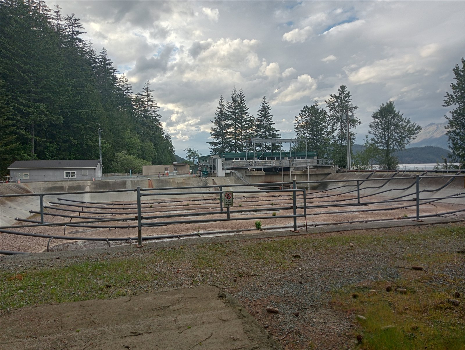
Area 4 begins with an infrastructure question. In 2008, senior-government funding was announced for a sewer connection from Harrison to the District of Kent system that would have allowed Harrison's plant to be decommissioned. Engineering and municipal records show that the regional option progressed into cost and route analysis.

A 2010 Village record states that the Kent connection was abandoned and the project scope changed to upgrading the existing Harrison plant. The record assembled so far indicates that project cost and agreement terms were central concerns. It does not justify assigning personal blame, and important documents remain missing.

In January 2026, the Village reported that heavy rainfall caused stormwater to enter the sanitary system and that the plant operated at full capacity during the event. The Village also stated that all wastewater was treated and that it was addressing identified infiltration locations.

Harrison Rising proposes a modern, independent comparison of regional connection and continued local-plant investment. Only if a regional solution proves technically, environmentally, financially and institutionally stronger would decommissioning and remediation be considered.

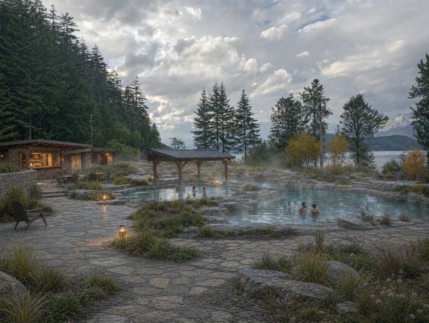
The reclaimed site could then become Harrison's principal public thermal-bathing and wellness destination, with low-profile pools and buildings placed to preserve direct views of Harrison Lake and the surrounding mountains.

Possible benefits

  • Compare long-term regional infrastructure with repeated site upgrades
  • Potentially recover lakeside land for public wellness and economic activity

Immediate constraints

  • Engineering, cost, governance, remediation and intergovernmental agreement
  • Thermal-water access, environmental approvals and a viable public model

Design and decision principles

What should guide the work

  1. Solve the wastewater question before treating the land as available for another use.
  2. Use current engineering, lifecycle cost, climate, flood and capacity assumptions rather than reusing 2009 estimates.
  3. Present the 2008-2010 record fairly and distinguish documents, interpretation and unanswered questions.
  4. Require environmental remediation and public-health approvals before any wellness use.
  5. Keep buildings low and preserve the site's lake, forest and mountain setting.

Still unresolved

Questions that must remain visible

  • What would a modern pipeline route, Kent capacity agreement and lifecycle cost look like?
  • What formal resolution changed the project direction in 2010, and how was funding amended?
  • What are the full present-day costs and risks of maintaining, protecting and expanding the existing plant?
  • What legal and practical arrangements would provide public access to thermal water?
  • What public, partnership or operating model could make the wellness park viable?

Evidence currently connected to this area

11 public catalogue entries

What would help now
Engineering and environmental studies, missing 2008-2010 records, historical photographs, sightlines and first-hand knowledge.

Email an Area 04 contribution
Area 05

Regional Hiking and Cycling Network

Working method published

Working overview

Area 5 proposes improving existing hiking trails, cycling routes and village-to-trail connections before gradually developing new authorized routes around Harrison Lake, Harrison River, Hicks Lake and the surrounding mountains.

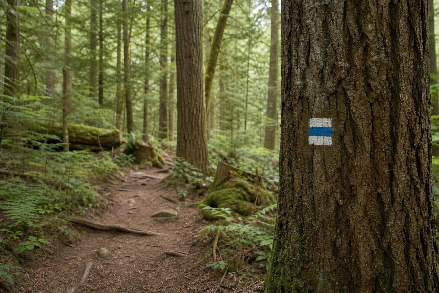
Wayfinding would adapt a proven colour-stripe system to British Columbia's regulations and local conditions. Markers would be used sparingly: only at junctions, turns or places where the correct direction could reasonably be missed. Where permitted, one small painted marker on a suitable existing surface would provide reassurance without creating the appearance of a painted forest. Directional posts would be reserved for trailheads, major junctions and destinations.

A volunteer-based regional hiking and cycling club could help inspect, mark and maintain authorized routes. The club would seek formal agreements and work with Harrison Hot Springs, Kent, First Nations, landowners, provincial agencies and participating businesses.

Volunteers should be trained, insured, equipped and recognized. Benefits could include local-business discounts, guided outings, skills training, social events, equipment and public recognition. Stewardship should be valued rather than treated as free labour.

Possible benefits

  • Make outdoor routes easier to understand and maintain
  • Support recreation, local businesses and practical cycling connections

Immediate constraints

  • Land access, authorization, ecology, liability and insurance
  • Coordination with First Nations, landowners and government agencies

Proposed reassurance markers

Small, consistent and visible without filling the forest with signs.

Route colours identify the route—not difficulty. Difficulty, permitted uses and safety information would be shown separately at trailheads and important junctions.

Red route
Blue route
Green route
Yellow route
  • Painted on approved existing surfaces where practical and permitted.
  • Posts reserved mainly for trailheads, junctions and destinations.
  • Separate, larger visual treatment for authorized cycling routes.
  • One short pilot route before any broader rollout.

Design and decision principles

What should guide the work

  1. Improve and authorize existing routes before creating new ones.
  2. Use route colour for continuity, not as a substitute for difficulty or safety information.
  3. Use a single small painted marker only where route direction could be unclear; reserve posts for major decisions and destinations.
  4. Begin with one short pilot route and evaluate navigation, ecology, resident effects and maintenance effort.
  5. Provide volunteers with written roles, training, insurance, protective equipment, tools, expense support and recognition.

Still unresolved

Questions that must remain visible

  • Which routes are authorized, who owns them and who currently maintains them?
  • Which short loop offers a low-risk pilot with clear ownership and community value?
  • How should hiking, off-road cycling and village cycling signs be distinguished?
  • What insurance and stewardship agreement would protect volunteers and land managers?
  • Which routes or sensitive places should not be promoted publicly?

Evidence currently connected to this area

8 public catalogue entries

What would help now
Trail maps, confusing junctions, damaged signs, unsafe cycling gaps, drainage problems and regional aerial footage.

Email an Area 05 contribution