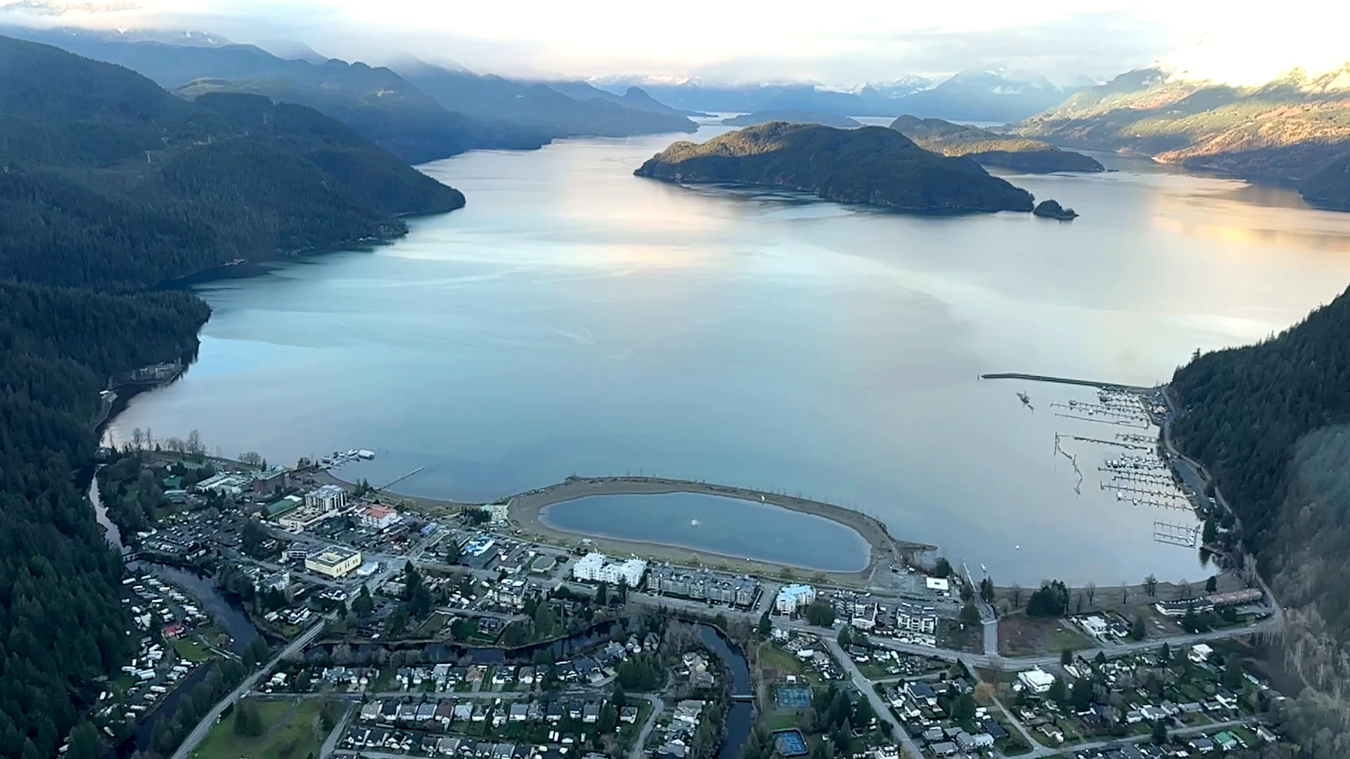
Five-area aerial overview
Aerial survey view used to understand the village, lake, mountains and relationships between the study areas.
- Record
- HRP001
- Date
- 9 December 2024
- Source / credit
- Ralph van Woerden
Public evidence library
Every entry has an identification number, area, material type, source or credit, date and review label. Official links open the original public source in a new tab.
A label describes what an item is—it does not mean that Harrison Rising endorses every statement in the source.
An official or primary public source linked to its publisher.
A project photograph or aerial item with suitable public-use permission.
A reference being studied and adapted—not a final local standard.
A proposed future idea, clearly separated from present conditions.
Aerial survey view used to understand the village, lake, mountains and relationships between the study areas.
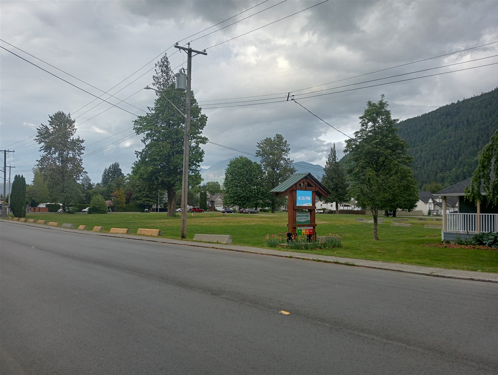
Street-level record of the proposed Village Heart site and its mountain backdrop.
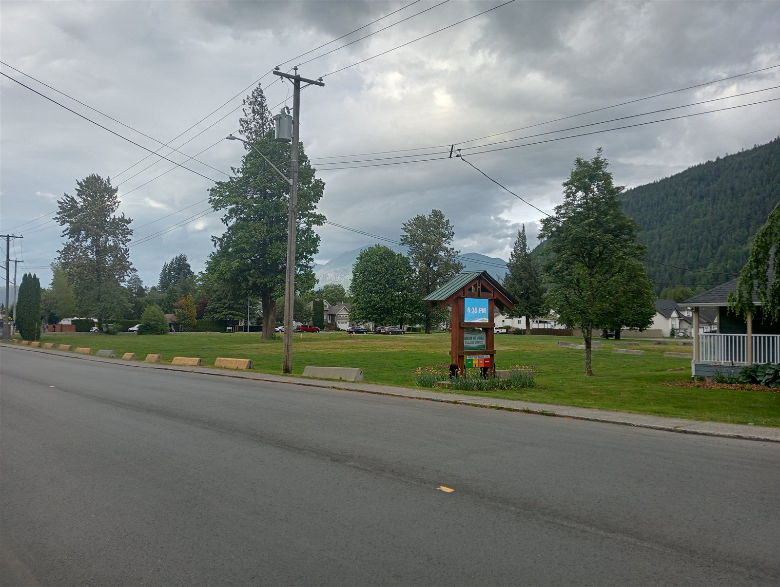
The retained Visitor Information Centre beside the present overflow-parking block.
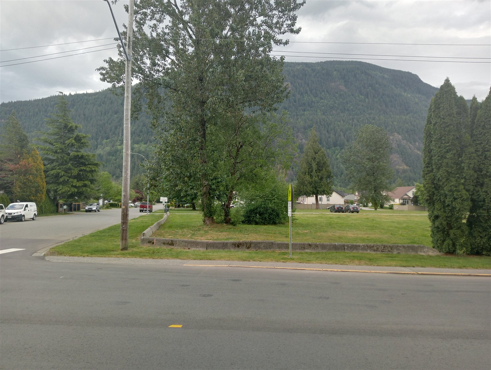
Present northern edge of the Area 1 block at Miami River Drive.
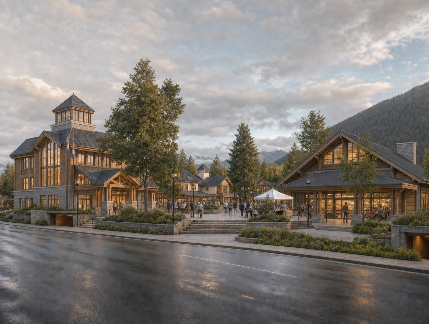
Approved website concept showing a civic plaza, municipal hall, grocery store and visible underground-parking access. It is an illustration, not a settled site plan.
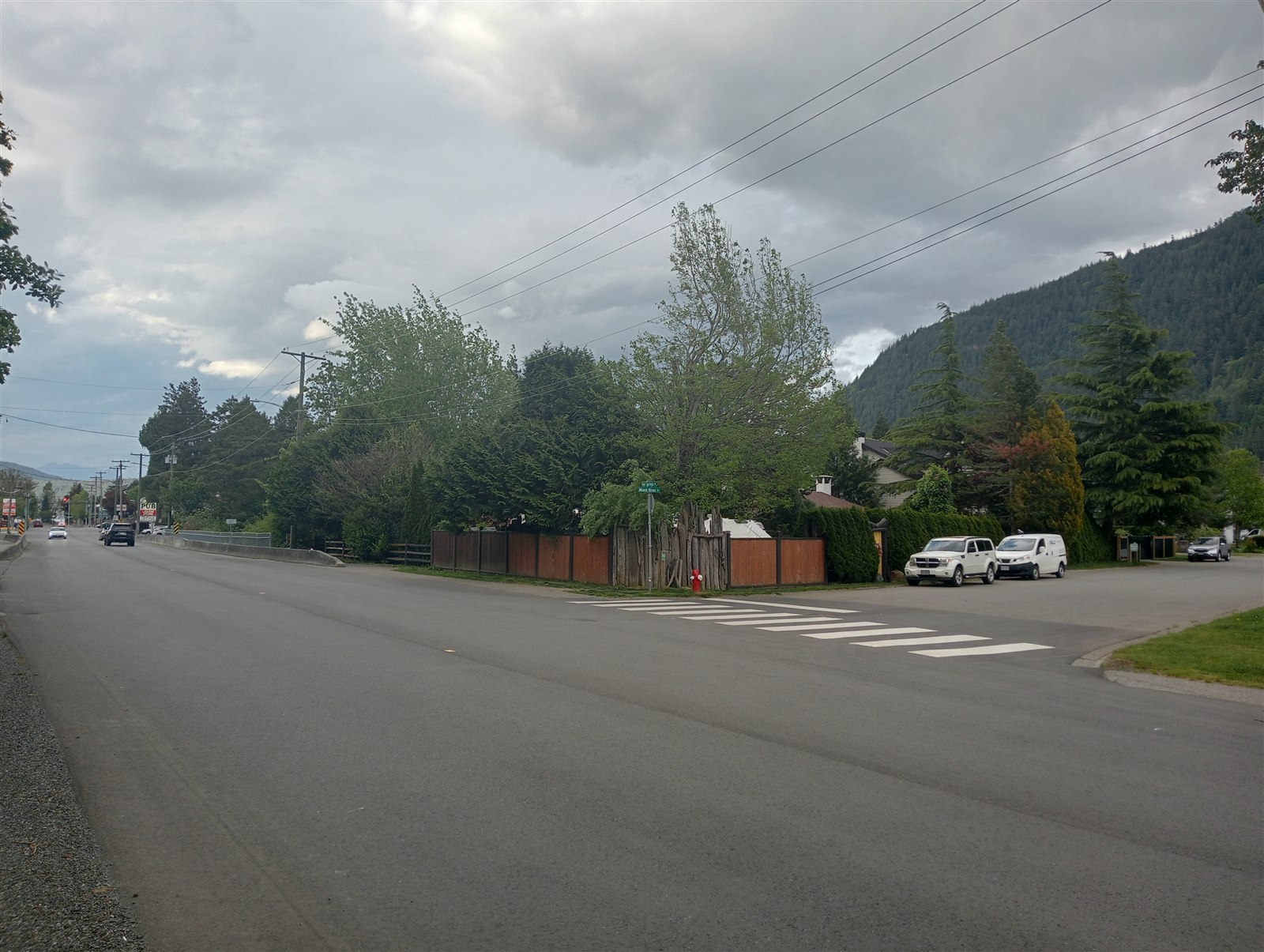
Street context for the proposed live/work frontage.
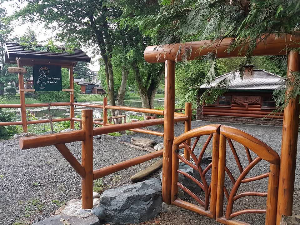
Current cabin grounds, gate and natural river-edge character.
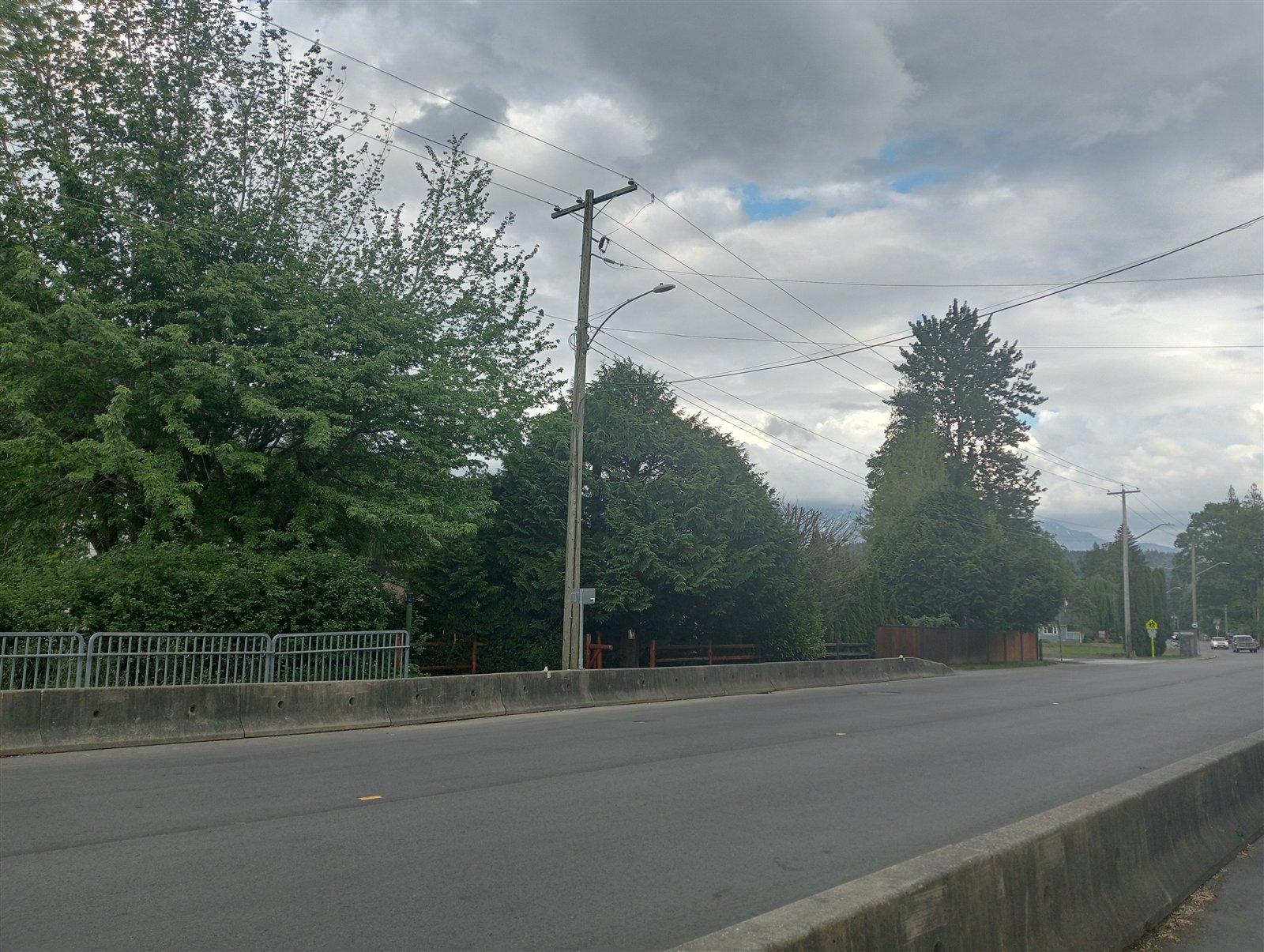
Existing riverside cabin and walkway context near the Miami River bridge.
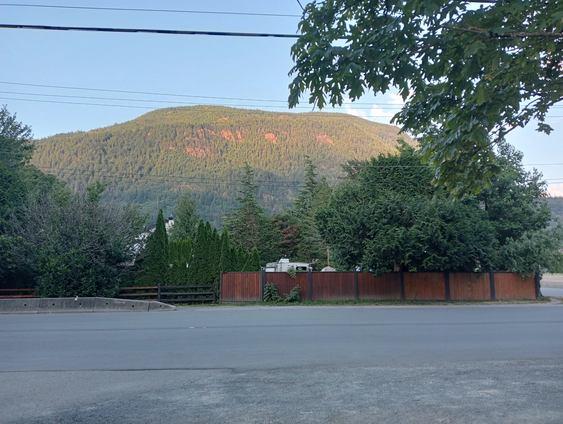
Direct existing-condition view used as the matching base for the approved live/work concept illustration.
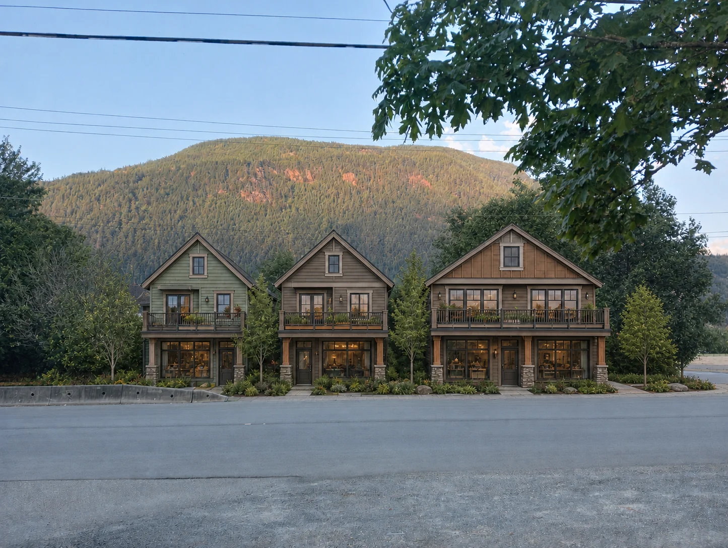
Approved website concept showing three modest live/work buildings and a wider corner building. The separate cabin-market concept remains to be developed.
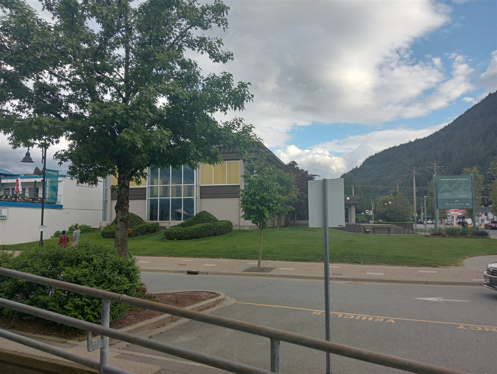
Present-day pool facade from Esplanade Avenue.
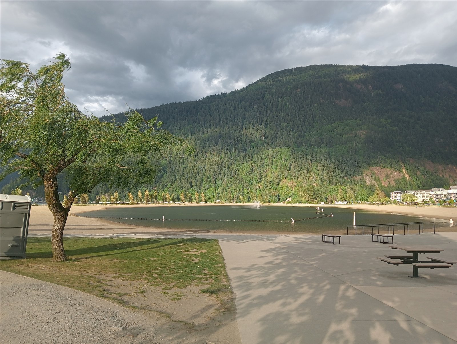
Existing beach, water basin, recreation plaza and mountain backdrop.
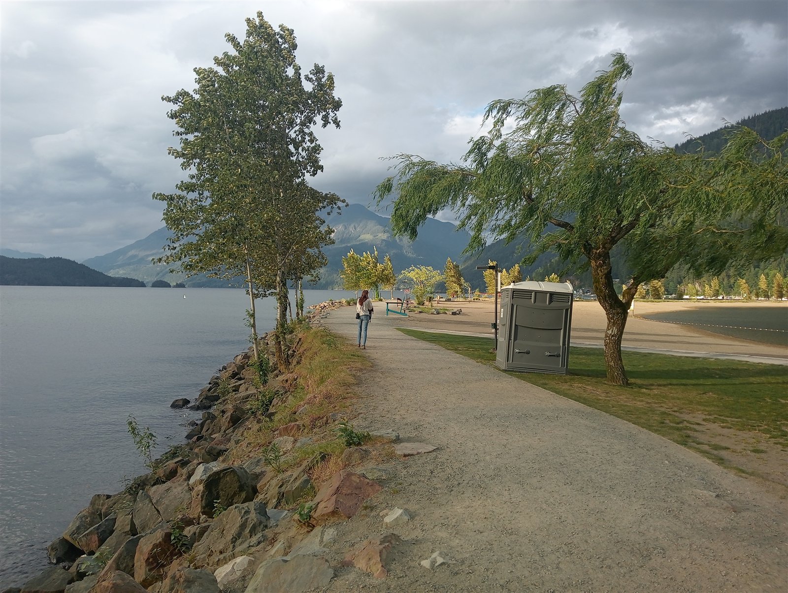
Current relationship between the beach, lagoon edge and pedestrian path.
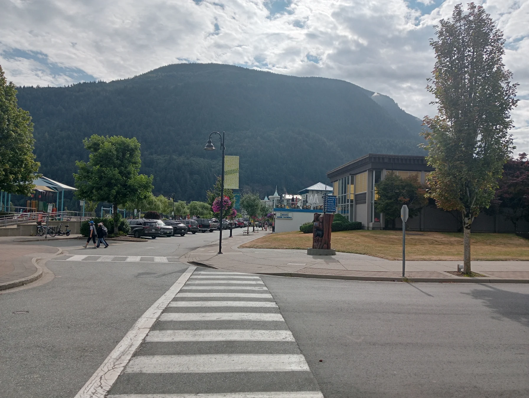
Existing-condition view used as the matching base for the approved pool, bridge and promenade concept.
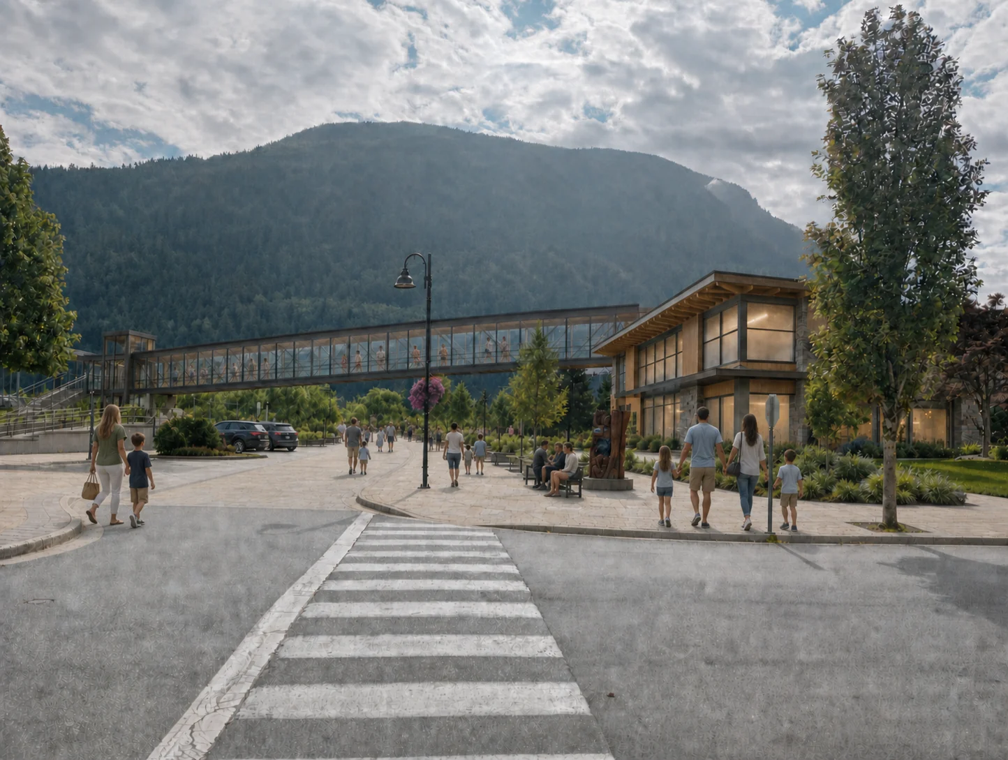
Approved website concept showing the modernized aquatic centre, glazed bridge and the promenade beginning east of Hot Springs Road.
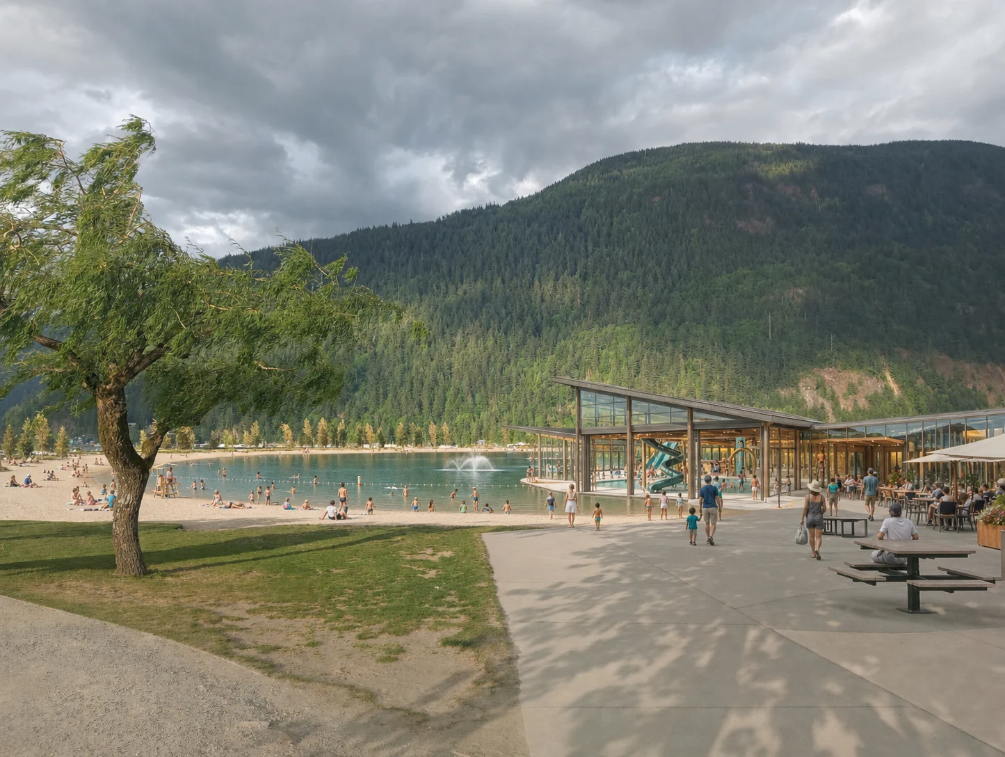
Approved website concept for a partially enclosed lagoon-beach waterpark that could open during summer. It is not an engineering design.
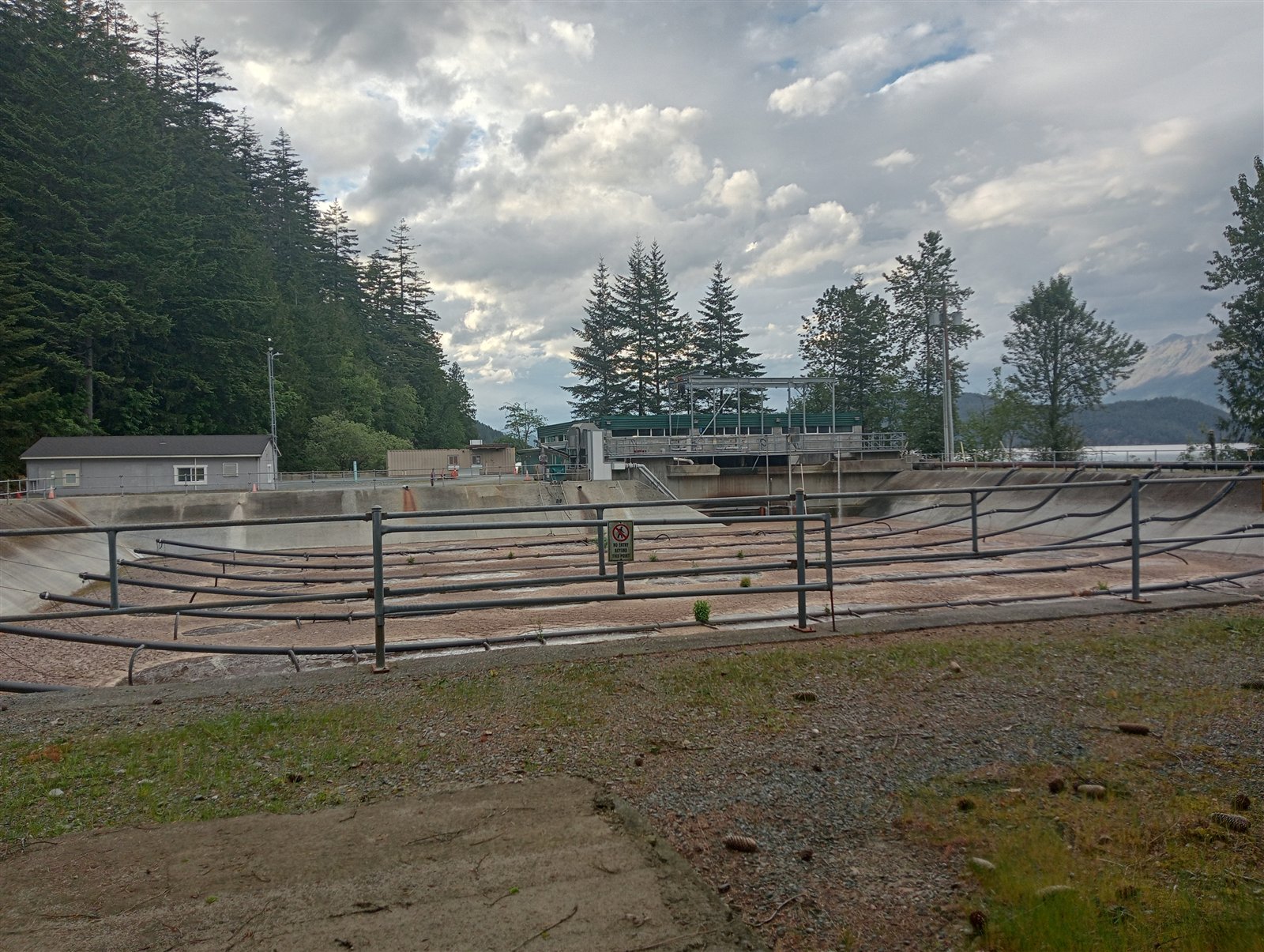
Treatment basin with the lake and mountain landscape beyond.
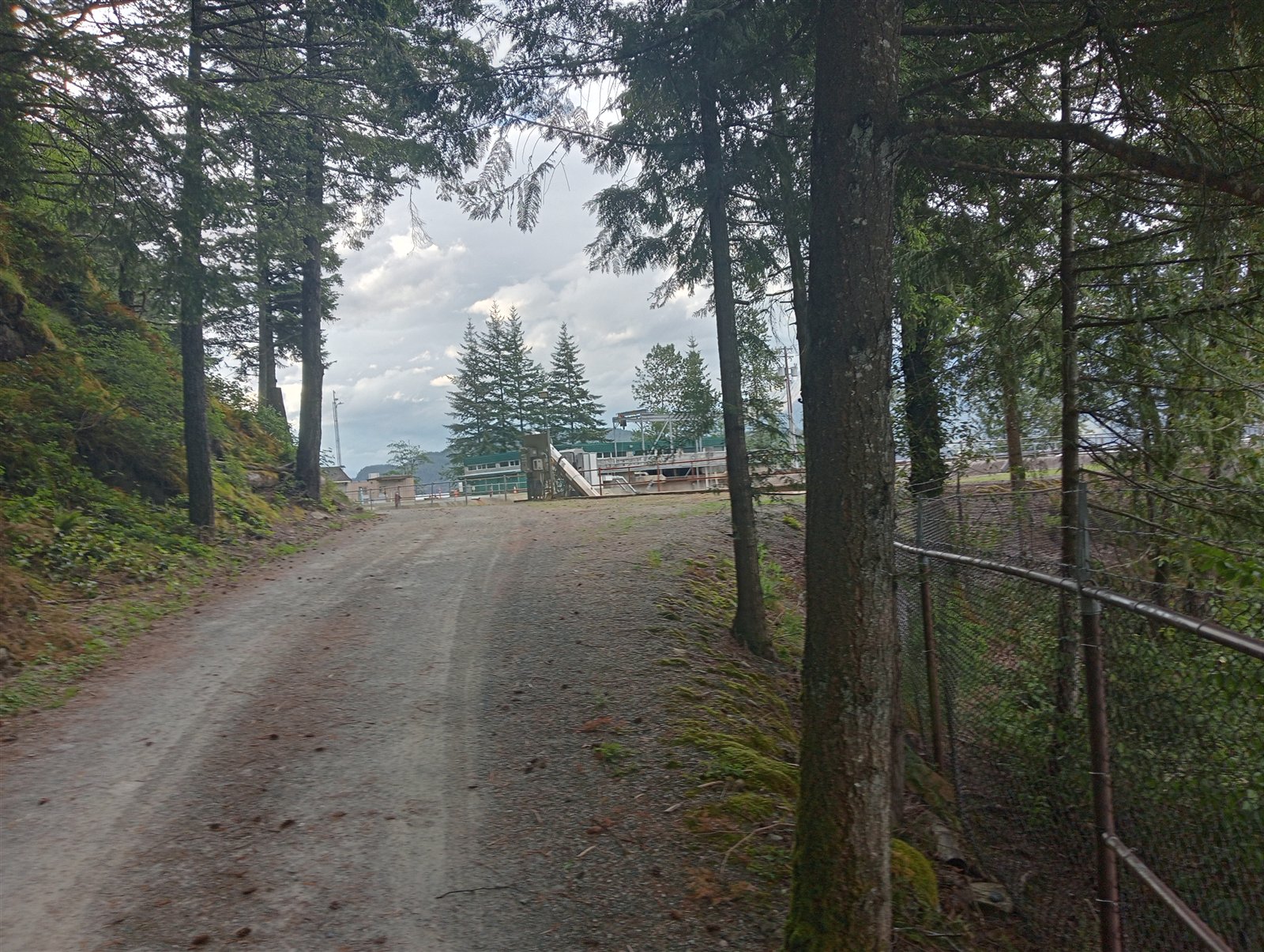
Existing low-profile approach through the wooded lakeside setting.
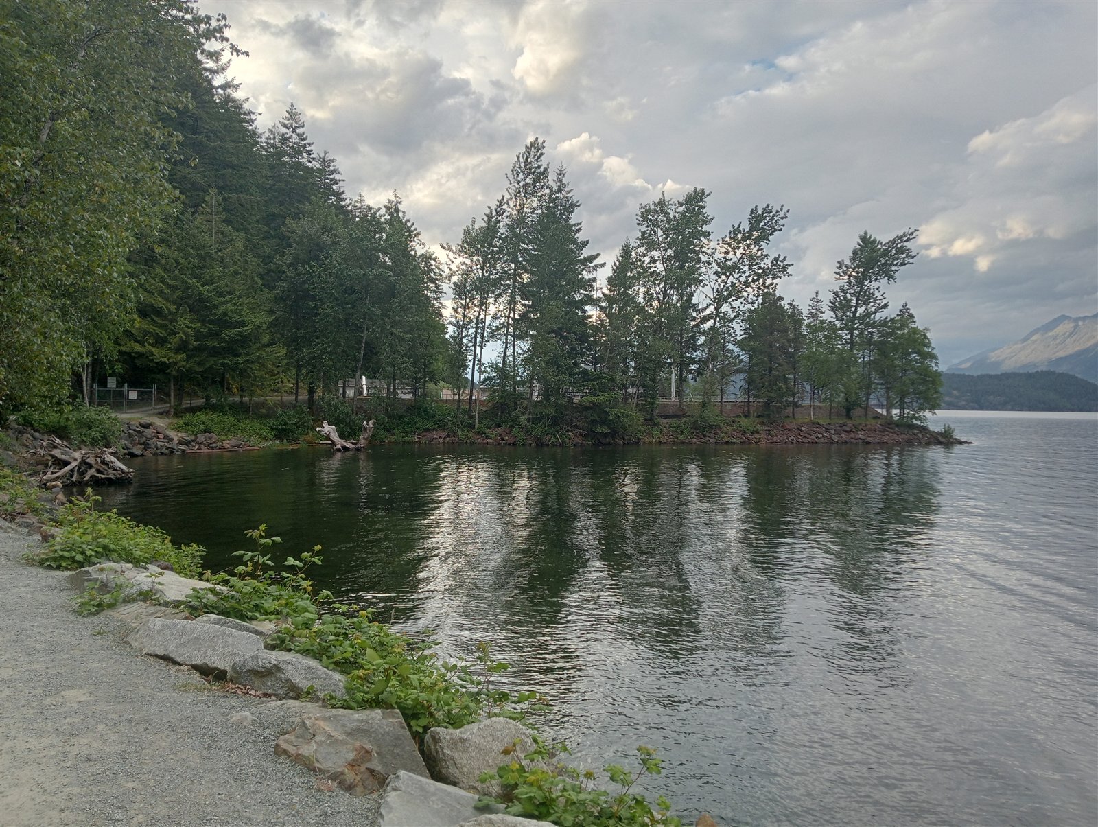
Landscape and views that would need protection in any future reuse.
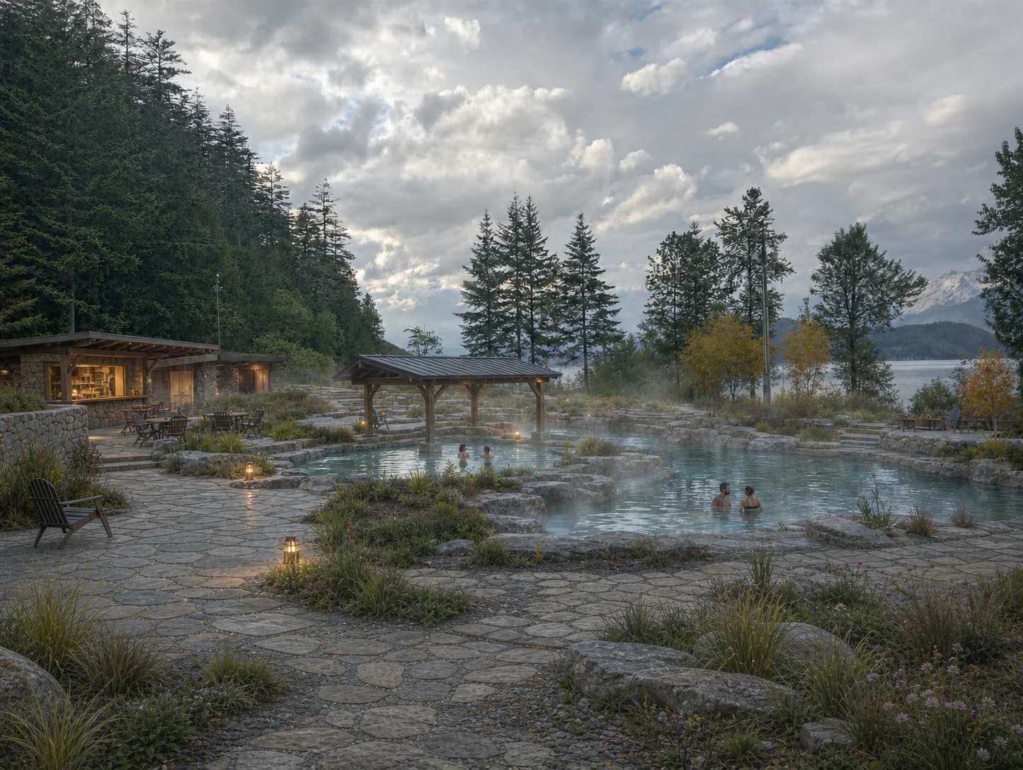
Approved website concept showing low-profile thermal pools, a small service kiosk and simple covered areas on a remediated site. It depends on resolving the wastewater question first.
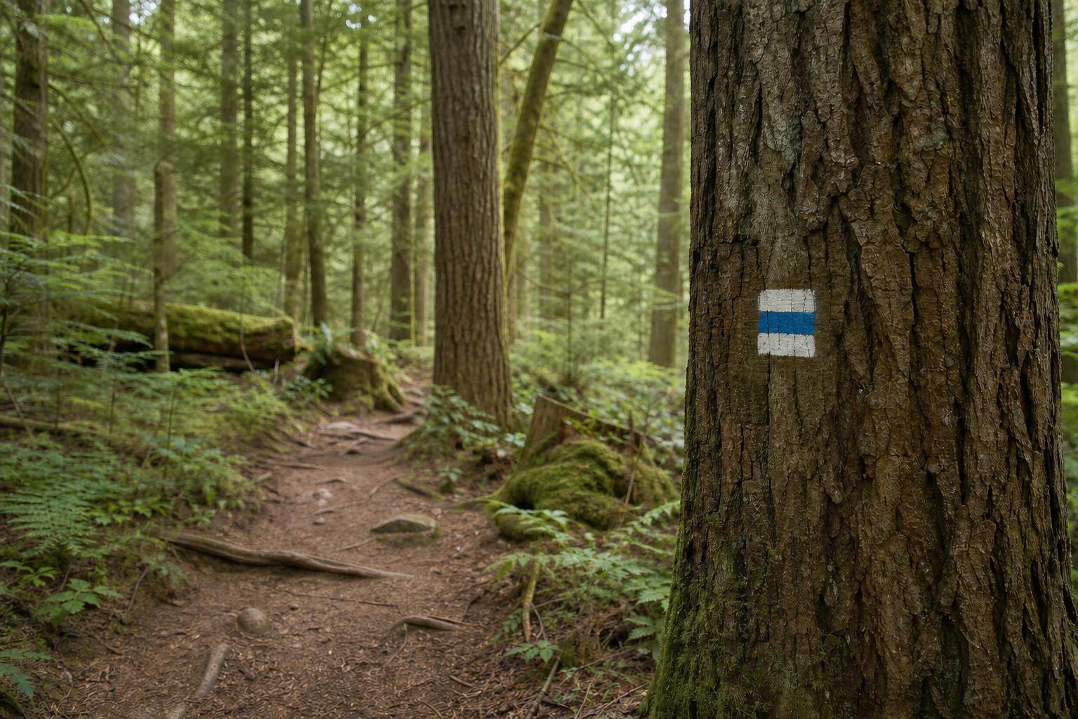
Photographic concept showing one small painted marker used only where the correct route could reasonably be missed. It is not an existing marked Harrison trail.
Village-wide planning context against which every Harrison Rising direction must be tested.
Current public information about parking operations and locations.
Public description of the facility that the Area 1 concept proposes to retain.
Municipal record relevant to river ecology and stewardship.
Village background page providing historical and territorial context.
Existing municipal framework relevant to any home-occupation or market proposal.
Council correspondence and public material relevant to pool access and the current community discussion.
Public-health record illustrating why lagoon-water use must remain conditional.
Follow-up public notice confirming the role of continuing monitoring.
Village statement on December 2025 stormwater inflow, full-capacity operation and treatment performance.
Current municipal information about local utility responsibilities.
Council update relevant to lakeside infrastructure and flood protection.
Reference explaining the consistent route-colour and reassurance-marker logic being considered for local adaptation.
Provincial guidance for authorized volunteer trail work and stewardship.
Provincial standards and responsibilities that a local system would need to respect.
Provincial framework for developing and maintaining recreation trails.
Provincial pathway for stewardship agreements, insurance and organized volunteer participation.
Czech-language primary source for marker geometry, route continuity and trained volunteer practice. HRR016 provides the accompanying English-language explanation.
Official regional park context relevant to the broader trail study area.
Federal record stating that the regional project would extend a sewer main to Agassiz and allow Harrison's plant to be decommissioned.
Municipal record stating that the Kent connection was abandoned and the scope changed to upgrading Harrison's plant.
Committee package documenting route, cost and feasibility work on the regional option.
Corrections are evidence too
Send the record ID, the correction and the source that supports it. The catalogue will be updated when the correction can be verified.
Submit a correction